Saidu Sharif geodata
Saidu Sharif (Khyber Pakhtunkhwa) is a seat of a second-order administrative division; located in Pakistan in Asia/Karachi (GMT+5) time zone. In our database, there are 416 cities with bigger population. Compared to other cities in Pakistan, 96.6% of cities are located further ↓South; 61.9% of cities are located further ←West and 88.3% of cities have lower elevation than Saidu Sharif. Note1


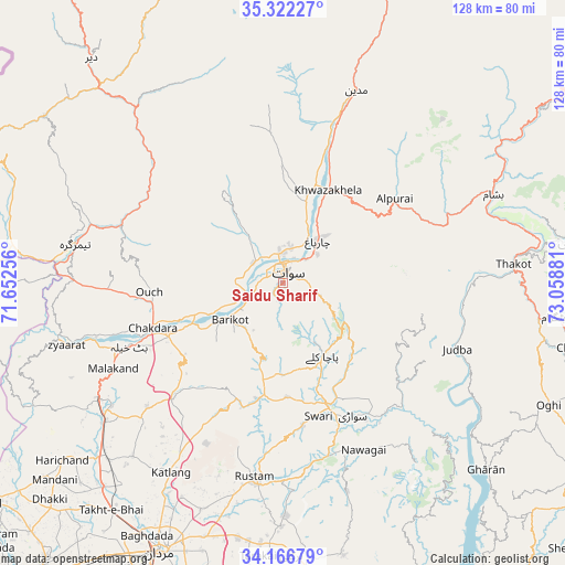
Saidu Sharif GPS coordinates[2]
34° 44' 47.58" North, 72° 21' 20.448" East
| Map corner | latitude | longitude |
|---|---|---|
| Upper-left | 35.32227°, | 71.65256° |
| Center: | 34.74655°, | 72.35568° |
| Lower-right: | 34.16679°, | 73.05881° |
| Map W x H: | 128.5×128.5 km | = 79.8×79.8mi |
| max Lat: | 36.32162° ⇑3.4% North |
| Saidu Sharif: | 34.74655° |
| min Lat: | ⇓96.6% South 24.14422° |
| min Long | Saidu Sharif | max Long |
| 61.74573° | 72.35568° | 75.63372° |
| W 61.9%⇐ | ⇒38.1% E |
Elevation
Elevation of Saidu Sharif is 957 m = 3140 ft, and this is 612 m = 2008 ft above average elevation for this country.
| Max E: |
2732 m = 8963 ft | 11.7% |
| Saidu Sharif | 957 m 3140 ft | |
| Avg. | 345 m = 1132 ft | |
Min E: |
3 m = 10 ft | 88.3% |
See also: Pakistan elevation on elevation.city.
Geographical zone
Saidu Sharif is located in North temperate zone (between Tropic of Cancer and the Arctic Circle). Distance of this Northern Tropic circle is 1257.5 km =781.4 mi to South.| Distance of | km | miles | from Saidu Sharif |
|---|---|---|---|
| North Pole | 6143.6 | 3817.5 | to North |
| Arctic Circle | 3537.7 | 2198.2 | to North |
| Tropic Cancer | 1257.5 | 781.4 | to South |
| Equator | 3863.5 | 2400.7 | to South |


Nearby cities:
15 places around Saidu Sharif: (largest is in red/bold)
• Alpurai
31.8 km =19.8 mi,  52°
52°
• Ashanagro Koto
71.7 km =44.6 mi,  188°
188°
• Bat Khela
37.8 km =23.5 mi,  247°
247°
• Battagram
61.5 km =38.2 mi,  97°
97°
• Daggar
28.7 km =17.8 mi,  155°
155°
• Kakad Wari Dir Upper
38 km =23.6 mi,  317°
317°
• Malakand
43.8 km =27.2 mi,  242°
242°
• Mardan
67.1 km =41.7 mi,  204°
204°
• Mingora
3.7 km =2.3 mi,  9°
9°
• Noorabad
65.5 km =40.7 mi,  212°
212°
• Shingli Bala
58 km =36 mi, 97°
• Swabi
70.4 km =43.7 mi,  171°
171°
• Timargara
47.5 km =29.5 mi,  280°
280°
• Upper Dir
67.3 km =41.8 mi, 319°
• Zaida
77.1 km =47.9 mi, 172°
Sources, notices
• [Note1] Compared only with cities in Pakistan existing in our database
• [Src1] Map data: © OpenStreetMap contributors (CC-BY-SA)
• [Src2] Other city data from geonames.org with taken over terms of usage.
• [Src3] Geographical zone / Annual Mean Temperature by Robert A. Rohde @ Wikipedia
