Witonia geodata
Witonia (Łódź Voivodeship) is a seat of a third-order administrative division; located in Poland in Europe/Warsaw (GMT+2) time zone. With population of 1,130 people, there are 2270 cities with bigger population in this country. Compared to other cities in Poland, 68.8% of cities are located further ↓South; 54.4% of cities are located further →East and 78.8% of cities have higher elevation than Witonia. Note1


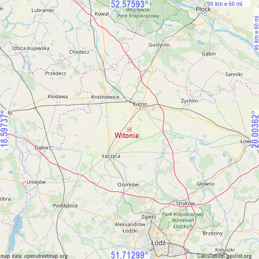
Witonia GPS coordinates[2]
52° 8' 47.58" North, 19° 18' 1.764" East
| Map corner | latitude | longitude |
|---|---|---|
| Upper-left | 52.57593°, | 18.59737° |
| Center: | 52.14655°, | 19.30049° |
| Lower-right: | 51.71299°, | 20.00362° |
| Map W x H: | 95.9×95.9 km | = 59.6×59.6mi |
| max Lat: | 54.83135° ⇑31.2% North |
| Witonia: | 52.14655° |
| min Lat: | ⇓68.8% South 49.21328° |
| min Long | Witonia | max Long |
| 14.20249° | 19.30049° | 24.03723° |
| W 45.6%⇐ | ⇒54.4% E |
Elevation
Elevation of Witonia is 102 m = 335 ft, and this is 89.4 m = 293 ft below average elevation for this country.
| Max E: |
974 m = 3196 ft | 78.8% |
| Avg. | 191.4 m = 628 ft | |
| Witonia | 102 m = 335 ft | |
Min E: |
-3 m = -10 ft | 21.2% |
See also: Poland elevation on elevation.city.
Geographical zone
Witonia is located in North temperate zone (between Tropic of Cancer and the Arctic Circle). Distance of this North polar circle is 1603 km =996.1 mi to North.| Distance of | km | miles | from Witonia |
|---|---|---|---|
| North Pole | 4208.9 | 2615.3 | to North |
| Arctic Circle | 1603 | 996.1 | to North |
| Tropic Cancer | 3192.2 | 1983.5 | to South |
| Equator | 5798.2 | 3602.8 | to South |


Nearby cities:
15 places around Witonia: (largest is in red/bold)
• Bedlno
20 km =12.4 mi,  69°
69°
• Błonie
13.6 km =8.5 mi,  235°
235°
• Daszyna
8.2 km =5.1 mi,  276°
276°
• Grabów
20.4 km =12.7 mi,  263°
263°
• Góra Świętej Małgorzaty
10 km =6.2 mi,  172°
172°
• Krośniewice
15.1 km =9.4 mi,  323°
323°
• Krzyżanów
11.4 km =7.1 mi, 68°
• Kutno
10.3 km =6.4 mi,  24°
24°
• Nowe Ostrowy
18.9 km =11.7 mi,  337°
337°
• Oporów
22.2 km =13.8 mi,  53°
53°
• Ostrowy
19.8 km =12.3 mi,  332°
332°
• Ozorków
20.4 km =12.7 mi,  181°
181°
• Piątek
15 km =9.3 mi,  125°
125°
• Strzelce
20.1 km =12.5 mi, 21°
• Łęczyca
11.9 km =7.4 mi,  215°
215°
Sources, notices
• [Note1] Compared only with cities in Poland existing in our database
• [Src1] Map data: © OpenStreetMap contributors (CC-BY-SA)
• [Src2] Other city data from geonames.org with taken over terms of usage.
• [Src3] Geographical zone / Annual Mean Temperature by Robert A. Rohde @ Wikipedia
