Góra Świętej Małgorzaty geodata
Góra Świętej Małgorzaty (Łódź Voivodeship) is a seat of a third-order administrative division; located in Poland in Europe/Warsaw (GMT+2) time zone. With population of 357 people, there are 3606 cities with bigger population in this country. Compared to other cities in Poland, 66.6% of cities are located further ↓South; 54.1% of cities are located further →East and 73.5% of cities have higher elevation than Góra Świętej Małgorzaty. Note1
Administrative division(s):
- Level 1: Łódź Voivodeship
- Level 2: Powiat łęczycki
- Level 3: Góra Świętej Małgorzaty
Current local time in Góra Świętej Małgorzaty:
04:09 AM, SaturdayDifference from your time zone: hours


Góra Świętej Małgorzaty GPS coordinates[2]
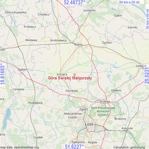
52° 3' 25.668" North, 19° 19' 11.892" East
| Map corner | latitude | longitude |
|---|---|---|
| Upper-left | 52.48737°, | 18.61685° |
| Center: | 52.05713°, | 19.31997° |
| Lower-right: | 51.6227°, | 20.0231° |
| Map W x H: | 96.1×96.1 km | = 59.7×59.7mi |
| max Lat: | 54.83135° ⇑33.4% North |
| Góra Świętej Małgorzaty: | 52.05713° |
| min Lat: | ⇓66.6% South 49.21328° |
| min Long | Góra Świętej | max Long |
| 14.20249° | 19.31997° | 24.03723° |
| W 45.9%⇐ | ⇒54.1% E |
Elevation
Elevation of Góra Świętej Małgorzaty is 114 m = 374 ft, and this is 77.4 m = 254 ft below average elevation for this country.
| Max E: |
974 m = 3196 ft | 73.5% |
| Avg. | 191.4 m = 628 ft | |
| Góra Świętej Małgorzaty | 114 m = 374 ft | |
Min E: |
-3 m = -10 ft | 26.5% |
See also: Poland elevation on elevation.city.
Geographical zone
Góra Świętej Małgorzaty is located in North temperate zone (between Tropic of Cancer and the Arctic Circle). Distance of this North polar circle is 1613 km =1002.3 mi to North.| Distance of | km | miles | from Góra Świętej Małgorzaty |
|---|---|---|---|
| North Pole | 4218.9 | 2621.5 | to North |
| Arctic Circle | 1613 | 1002.3 | to North |
| Tropic Cancer | 3182.3 | 1977.4 | to South |
| Equator | 5788.2 | 3596.6 | to South |


Nearby cities:
15 places around Góra Świętej Małgorzaty: (largest is in red/bold)
• Bielawy
23 km =14.3 mi,  84°
84°
• Błonie
12.7 km =7.9 mi,  279°
279°
• Dalików
23.6 km =14.7 mi,  215°
215°
• Daszyna
14.4 km =8.9 mi,  319°
319°
• Grabów
23 km =14.3 mi,  289°
289°
• Krzyżanów
16.9 km =10.5 mi,  33°
33°
• Kutno
19.5 km =12.1 mi,  8°
8°
• Ozorków
10.6 km =6.6 mi,  190°
190°
• Parzęczew
14.4 km =8.9 mi,  212°
212°
• Piątek
11 km =6.8 mi, 83°
• Szczawin
20.9 km =13 mi,  146°
146°
• Wartkowice
23.6 km =14.7 mi,  247°
247°
• Witonia
10 km =6.2 mi,  352°
352°
• Zgierz
23.2 km =14.4 mi,  165°
165°
• Łęczyca
8.2 km =5.1 mi,  271°
271°
Sources, notices
• [Note1] Compared only with cities in Poland existing in our database
• [Src1] Map data: © OpenStreetMap contributors (CC-BY-SA)
• [Src2] Other city data from geonames.org with taken over terms of usage.
• [Src3] Geographical zone / Annual Mean Temperature by Robert A. Rohde @ Wikipedia
