Błonie geodata
Błonie (Łódź Voivodeship) is a populated place; located in Poland in Europe/Warsaw (GMT+2) time zone. With population of 550 people, there are 3408 cities with bigger population in this country. Compared to other cities in Poland, 67.1% of cities are located further ↓South; 57.4% of cities are located further →East and 78.8% of cities have higher elevation than Błonie. Note1


Błonie GPS coordinates[2]
52° 4' 35.976" North, 19° 8' 10.356" East
| Map corner | latitude | longitude |
|---|---|---|
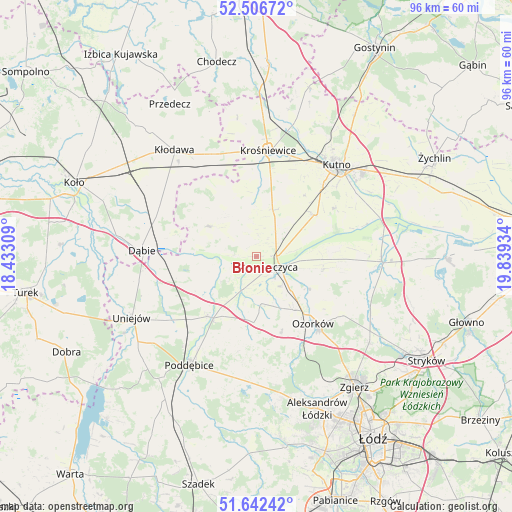
| Upper-left | 52.50672°, | 18.43309° |
| Center: | 52.07666°, | 19.13621° |
| Lower-right: | 51.64242°, | 19.83934° |
| Map W x H: | 96.1×96.1 km | = 59.7×59.7mi |
| max Lat: | 54.83135° ⇑32.9% North |
| Błonie: | 52.07666° |
| min Lat: | ⇓67.1% South 49.21328° |
| min Long | Błonie | max Long |
| 14.20249° | 19.13621° | 24.03723° |
| W 42.6%⇐ | ⇒57.4% E |
Elevation
Elevation of Błonie is 102 m = 335 ft, and this is 89.4 m = 293 ft below average elevation for this country.
| Max E: |
974 m = 3196 ft | 78.8% |
| Avg. | 191.4 m = 628 ft | |
| Błonie | 102 m = 335 ft | |
Min E: |
-3 m = -10 ft | 21.2% |
See also: Poland elevation on elevation.city.
Geographical zone
Błonie is located in North temperate zone (between Tropic of Cancer and the Arctic Circle). Distance of this North polar circle is 1610.8 km =1000.9 mi to North.| Distance of | km | miles | from Błonie |
|---|---|---|---|
| North Pole | 4216.7 | 2620.1 | to North |
| Arctic Circle | 1610.8 | 1000.9 | to North |
| Tropic Cancer | 3184.5 | 1978.8 | to South |
| Equator | 5790.4 | 3598 | to South |


Nearby cities:
15 places around Błonie: (largest is in red/bold)
• Chodów
21 km =13 mi,  336°
336°
• Dalików
21.4 km =13.3 mi,  183°
183°
• Daszyna
9.2 km =5.7 mi,  19°
19°
• Dąbie
21.5 km =13.4 mi,  272°
272°
• Grabów
10.7 km =6.6 mi,  301°
301°
• Góra Świętej Małgorzaty
12.7 km =7.9 mi,  99°
99°
• Krośniewice
20.1 km =12.5 mi,  6°
6°
• Kutno
23.1 km =14.4 mi,  42°
42°
• Olszówka
22.5 km =14 mi, 304°
• Ozorków
16.5 km =10.3 mi,  139°
139°
• Parzęczew
15 km =9.3 mi,  161°
161°
• Wartkowice
14.5 km =9 mi,  219°
219°
• Witonia
13.6 km =8.5 mi,  55°
55°
• Łęczyca
4.7 km =2.9 mi,  113°
113°
• Świnice Warckie
15.5 km =9.6 mi,  255°
255°
Sources, notices
• [Note1] Compared only with cities in Poland existing in our database
• [Src1] Map data: © OpenStreetMap contributors (CC-BY-SA)
• [Src2] Other city data from geonames.org with taken over terms of usage.
• [Src3] Geographical zone / Annual Mean Temperature by Robert A. Rohde @ Wikipedia
