Syców geodata
Syców (Lower Silesia) is a populated place; located in Poland in Europe/Warsaw (GMT+2) time zone. With population of 10,809 people, there are 423 cities with bigger population in this country. Compared to other cities in Poland, 53.3% of cities are located further ↓South; 78.1% of cities are located further →East and 51.3% of cities have higher elevation than Syców. Note1


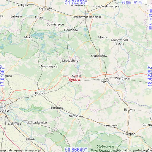
Syców GPS coordinates[2]
51° 18' 29.304" North, 17° 43' 11.244" East
| Map corner | latitude | longitude |
|---|---|---|
| Upper-left | 51.74558°, | 17.01667° |
| Center: | 51.30814°, | 17.71979° |
| Lower-right: | 50.86649°, | 18.42292° |
| Map W x H: | 97.7×97.7 km | = 60.7×60.7mi |
| max Lat: | 54.83135° ⇑46.7% North |
| Syców: | 51.30814° |
| min Lat: | ⇓53.3% South 49.21328° |
| min Long | Syców | max Long |
| 14.20249° | 17.71979° | 24.03723° |
| W 21.9%⇐ | ⇒78.1% E |
Elevation
Elevation of Syców is 169 m = 554 ft, and this is 22.4 m = 73 ft below average elevation for this country.
| Max E: |
974 m = 3196 ft | 51.3% |
| Avg. | 191.4 m = 628 ft | |
| Syców | 169 m = 554 ft | |
Min E: |
-3 m = -10 ft | 48.7% |
See also: Poland elevation on elevation.city.
Geographical zone
Syców is located in North temperate zone (between Tropic of Cancer and the Arctic Circle). Distance of this North polar circle is 1696.2 km =1054 mi to North.| Distance of | km | miles | from Syców |
|---|---|---|---|
| North Pole | 4302.1 | 2673.2 | to North |
| Arctic Circle | 1696.2 | 1054 | to North |
| Tropic Cancer | 3099 | 1925.6 | to South |
| Equator | 5704.9 | 3544.9 | to South |


Nearby cities:
15 places around Syców: (largest is in red/bold)
• Baranów
20.4 km =12.7 mi,  104°
104°
• Bralin
13 km =8.1 mi, 101°
• Dziadowa Kłoda
8.1 km =5 mi,  185°
185°
• Idzikowice
18.1 km =11.2 mi, 185°
• Kobyla Góra
11.4 km =7.1 mi,  46°
46°
• Kępno
19 km =11.8 mi, 100°
• Miechów
7 km =4.3 mi,  144°
144°
• Międzybórz
10.5 km =6.5 mi,  339°
339°
• Ostrzeszów
19.8 km =12.3 mi, 48°
• Perzów
7.2 km =4.5 mi,  119°
119°
• Rychtal
20.3 km =12.6 mi,  153°
153°
• Solniki Wielkie
23.5 km =14.6 mi,  226°
226°
• Sośnie
19.3 km =12 mi, 341°
• Twardogóra
18.5 km =11.5 mi,  289°
289°
• Wilków
23.3 km =14.5 mi, 189°
Sources, notices
• [Note1] Compared only with cities in Poland existing in our database
• [Src1] Map data: © OpenStreetMap contributors (CC-BY-SA)
• [Src2] Other city data from geonames.org with taken over terms of usage.
• [Src3] Geographical zone / Annual Mean Temperature by Robert A. Rohde @ Wikipedia
