Kobyla Góra geodata
Kobyla Góra (Greater Poland) is a seat of a third-order administrative division; located in Poland in Europe/Warsaw (GMT+2) time zone. With population of 2,000 people, there are 1469 cities with bigger population in this country. Compared to other cities in Poland, 54.6% of cities are located further ↓South; 76.8% of cities are located further →East and 60.3% of cities have lower elevation than Kobyla Góra. Note1
Administrative division(s):
- Level 1: Greater Poland
- Level 2: Powiat ostrzeszowski
- Level 3: Kobyla Góra


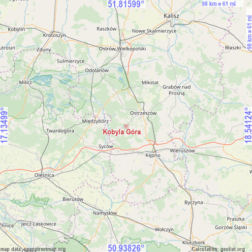
Kobyla Góra GPS coordinates[2]
51° 22' 45.228" North, 17° 50' 17.196" East
| Map corner | latitude | longitude |
|---|---|---|
| Upper-left | 51.81599°, | 17.13499° |
| Center: | 51.37923°, | 17.83811° |
| Lower-right: | 50.93826°, | 18.54124° |
| Map W x H: | 97.6×97.6 km | = 60.6×60.6mi |
| max Lat: | 54.83135° ⇑45.4% North |
| Kobyla Góra: | 51.37923° |
| min Lat: | ⇓54.6% South 49.21328° |
| min Long | Kobyla Góra | max Long |
| 14.20249° | 17.83811° | 24.03723° |
| W 23.2%⇐ | ⇒76.8% E |
Elevation
Elevation of Kobyla Góra is 201 m = 659 ft, and this is 9.6 m = 31 ft above average elevation for this country.
| Max E: |
974 m = 3196 ft | 39.7% |
| Kobyla Góra | 201 m 659 ft | |
| Avg. | 191.4 m = 628 ft | |
Min E: |
-3 m = -10 ft | 60.3% |
See also: Poland elevation on elevation.city.
Geographical zone
Kobyla Góra is located in North temperate zone (between Tropic of Cancer and the Arctic Circle). Distance of this North polar circle is 1688.3 km =1049.1 mi to North.| Distance of | km | miles | from Kobyla Góra |
|---|---|---|---|
| North Pole | 4294.2 | 2668.3 | to North |
| Arctic Circle | 1688.3 | 1049.1 | to North |
| Tropic Cancer | 3106.9 | 1930.5 | to South |
| Equator | 5712.8 | 3549.8 | to South |


Nearby cities:
15 places around Kobyla Góra: (largest is in red/bold)
• Baranów
17.3 km =10.7 mi,  138°
138°
• Bralin
11.3 km =7 mi,  156°
156°
• Doruchów
17.1 km =10.6 mi,  75°
75°
• Dziadowa Kłoda
18.3 km =11.4 mi,  209°
209°
• Garki
22.2 km =13.8 mi,  322°
322°
• Kępno
15.4 km =9.6 mi, 136°
• Miechów
14.2 km =8.8 mi,  196°
196°
• Mikstat
19.4 km =12.1 mi,  28°
28°
• Międzybórz
12.1 km =7.5 mi,  279°
279°
• Ostrzeszów
8.4 km =5.2 mi,  51°
51°
• Perzów
11.6 km =7.2 mi,  189°
189°
• Przygodzice
23.7 km =14.7 mi,  357°
357°
• Sośnie
17.6 km =10.9 mi,  306°
306°
• Syców
11.4 km =7.1 mi,  226°
226°
• Słupia pod Kępnem
21.1 km =13.1 mi, 137°
Sources, notices
• [Note1] Compared only with cities in Poland existing in our database
• [Src1] Map data: © OpenStreetMap contributors (CC-BY-SA)
• [Src2] Other city data from geonames.org with taken over terms of usage.
• [Src3] Geographical zone / Annual Mean Temperature by Robert A. Rohde @ Wikipedia
