Międzybórz geodata
Międzybórz (Lower Silesia) is a populated place; located in Poland in Europe/Warsaw (GMT+2) time zone. With population of 2,354 people, there are 1300 cities with bigger population in this country. Compared to other cities in Poland, 54.8% of cities are located further ↓South; 78.7% of cities are located further →East and 51.5% of cities have lower elevation than Międzybórz. Note1


Międzybórz GPS coordinates[2]
51° 23' 46.536" North, 17° 39' 57.96" East
| Map corner | latitude | longitude |
|---|---|---|
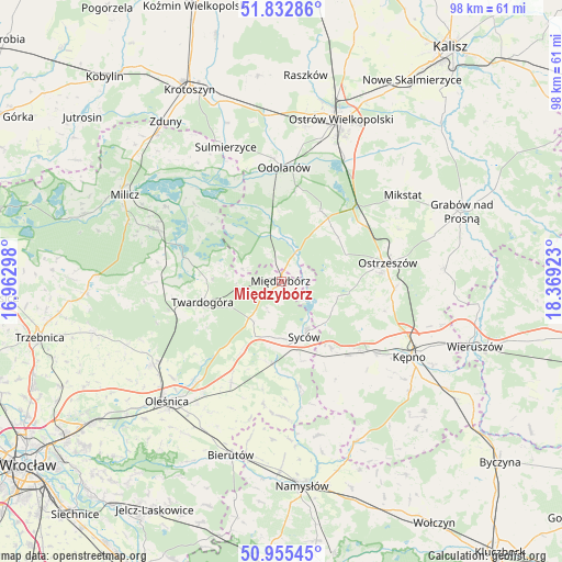
| Upper-left | 51.83286°, | 16.96298° |
| Center: | 51.39626°, | 17.6661° |
| Lower-right: | 50.95545°, | 18.36923° |
| Map W x H: | 97.6×97.6 km | = 60.6×60.6mi |
| max Lat: | 54.83135° ⇑45.2% North |
| Międzybórz: | 51.39626° |
| min Lat: | ⇓54.8% South 49.21328° |
| min Long | Międzybórz | max Long |
| 14.20249° | 17.6661° | 24.03723° |
| W 21.3%⇐ | ⇒78.7% E |
Elevation
Elevation of Międzybórz is 176 m = 577 ft, and this is 15.4 m = 51 ft below average elevation for this country.
| Max E: |
974 m = 3196 ft | 48.5% |
| Avg. | 191.4 m = 628 ft | |
| Międzybórz | 176 m = 577 ft | |
Min E: |
-3 m = -10 ft | 51.5% |
See also: Poland elevation on elevation.city.
Geographical zone
Międzybórz is located in North temperate zone (between Tropic of Cancer and the Arctic Circle). Distance of this North polar circle is 1686.4 km =1047.9 mi to North.| Distance of | km | miles | from Międzybórz |
|---|---|---|---|
| North Pole | 4292.3 | 2667.1 | to North |
| Arctic Circle | 1686.4 | 1047.9 | to North |
| Tropic Cancer | 3108.8 | 1931.7 | to South |
| Equator | 5714.7 | 3550.9 | to South |


Nearby cities:
15 places around Międzybórz: (largest is in red/bold)
• Bralin
20.5 km =12.7 mi,  126°
126°
• Dziadowa Kłoda
18.1 km =11.2 mi,  170°
170°
• Garki
15.8 km =9.8 mi,  354°
354°
• Janków Przygodzki
24 km =14.9 mi,  20°
20°
• Kobyla Góra
12.1 km =7.5 mi,  99°
99°
• Krośnice
23.1 km =14.4 mi,  292°
292°
• Miechów
17.4 km =10.8 mi,  153°
153°
• Odolanów
19.8 km =12.3 mi,  1°
1°
• Ostrzeszów
18.8 km =11.7 mi,  79°
79°
• Perzów
16.7 km =10.4 mi,  143°
143°
• Przygodzice
24.4 km =15.2 mi,  26°
26°
• Sośnie
8.8 km =5.5 mi, 345°
• Sulmierzyce
25.1 km =15.6 mi,  338°
338°
• Syców
10.5 km =6.5 mi,  159°
159°
• Twardogóra
14.1 km =8.8 mi,  255°
255°
Sources, notices
• [Note1] Compared only with cities in Poland existing in our database
• [Src1] Map data: © OpenStreetMap contributors (CC-BY-SA)
• [Src2] Other city data from geonames.org with taken over terms of usage.
• [Src3] Geographical zone / Annual Mean Temperature by Robert A. Rohde @ Wikipedia
