Sośnie geodata
Sośnie (Greater Poland) is a seat of a third-order administrative division; located in Poland in Europe/Warsaw (GMT+2) time zone. With population of 1,300 people, there are 2055 cities with bigger population in this country. Compared to other cities in Poland, 55.9% of cities are located further ↓South; 78.9% of cities are located further →East and 67.1% of cities have higher elevation than Sośnie. Note1


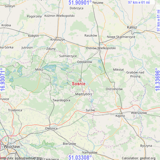
Sośnie GPS coordinates[2]
51° 28' 23.34" North, 17° 38' 1.788" East
| Map corner | latitude | longitude |
|---|---|---|
| Upper-left | 51.90901°, | 16.93071° |
| Center: | 51.47315°, | 17.63383° |
| Lower-right: | 51.03308°, | 18.33696° |
| Map W x H: | 97.4×97.4 km | = 60.5×60.5mi |
| max Lat: | 54.83135° ⇑44.1% North |
| Sośnie: | 51.47315° |
| min Lat: | ⇓55.9% South 49.21328° |
| min Long | Sośnie | max Long |
| 14.20249° | 17.63383° | 24.03723° |
| W 21.1%⇐ | ⇒78.9% E |
Elevation
Elevation of Sośnie is 128 m = 420 ft, and this is 63.4 m = 208 ft below average elevation for this country.
| Max E: |
974 m = 3196 ft | 67.1% |
| Avg. | 191.4 m = 628 ft | |
| Sośnie | 128 m = 420 ft | |
Min E: |
-3 m = -10 ft | 32.9% |
See also: Poland elevation on elevation.city.
Geographical zone
Sośnie is located in North temperate zone (between Tropic of Cancer and the Arctic Circle). Distance of this North polar circle is 1677.9 km =1042.6 mi to North.| Distance of | km | miles | from Sośnie |
|---|---|---|---|
| North Pole | 4283.8 | 2661.8 | to North |
| Arctic Circle | 1677.9 | 1042.6 | to North |
| Tropic Cancer | 3117.4 | 1937.1 | to South |
| Equator | 5723.3 | 3556.3 | to South |


Nearby cities:
15 places around Sośnie: (largest is in red/bold)
• Garki
7.2 km =4.5 mi,  5°
5°
• Gorzyce Wielkie
19.4 km =12.1 mi,  19°
19°
• Janków Przygodzki
17.5 km =10.9 mi,  37°
37°
• Kobyla Góra
17.6 km =10.9 mi,  126°
126°
• Krośnice
19 km =11.8 mi,  271°
271°
• Mikstat
24.4 km =15.2 mi,  74°
74°
• Międzybórz
8.8 km =5.5 mi,  165°
165°
• Odolanów
11.6 km =7.2 mi, 14°
• Ostrzeszów
21.4 km =13.3 mi,  104°
104°
• Ostrów Wielkopolski
23.5 km =14.6 mi,  30°
30°
• Przygodzice
18.6 km =11.6 mi, 44°
• Sulmierzyce
16.4 km =10.2 mi,  334°
334°
• Syców
19.3 km =12 mi,  161°
161°
• Twardogóra
16.6 km =10.3 mi,  223°
223°
• Wierzbno
18.5 km =11.5 mi, 7°
Sources, notices
• [Note1] Compared only with cities in Poland existing in our database
• [Src1] Map data: © OpenStreetMap contributors (CC-BY-SA)
• [Src2] Other city data from geonames.org with taken over terms of usage.
• [Src3] Geographical zone / Annual Mean Temperature by Robert A. Rohde @ Wikipedia
