Pietrowice Wielkie geodata
Pietrowice Wielkie (Silesia) is a seat of a third-order administrative division; located in Poland in Europe/Warsaw (GMT+2) time zone. With population of 2,239 people, there are 1340 cities with bigger population in this country. Compared to other cities in Poland, 78.6% of cities are located further ↑North; 74.3% of cities are located further →East and 62.4% of cities have lower elevation than Pietrowice Wielkie. Note1


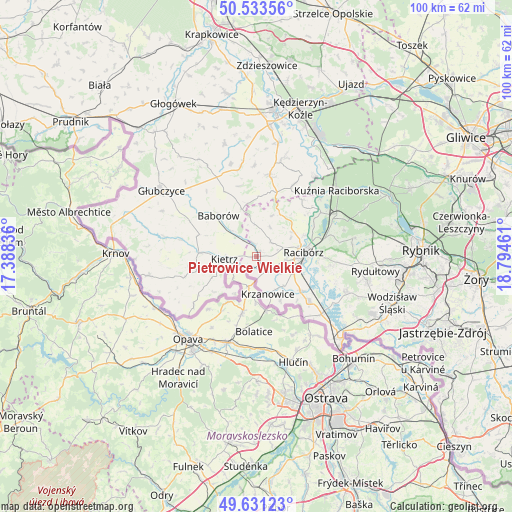
Pietrowice Wielkie GPS coordinates[2]
50° 5' 4.272" North, 18° 5' 29.328" East
| Map corner | latitude | longitude |
|---|---|---|
| Upper-left | 50.53356°, | 17.38836° |
| Center: | 50.08452°, | 18.09148° |
| Lower-right: | 49.63123°, | 18.79461° |
| Map W x H: | 100.3×100.3 km | = 62.3×62.3mi |
| max Lat: | 54.83135° ⇑78.6% North |
| Pietrowice Wielkie: | 50.08452° |
| min Lat: | ⇓21.4% South 49.21328° |
| min Long | Pietrowice Wiel | max Long |
| 14.20249° | 18.09148° | 24.03723° |
| W 25.7%⇐ | ⇒74.3% E |
Elevation
Elevation of Pietrowice Wielkie is 207 m = 679 ft, and this is 15.6 m = 51 ft above average elevation for this country.
| Max E: |
974 m = 3196 ft | 37.6% |
| Pietrowice Wielkie | 207 m 679 ft | |
| Avg. | 191.4 m = 628 ft | |
Min E: |
-3 m = -10 ft | 62.4% |
See also: Poland elevation on elevation.city.
Geographical zone
Pietrowice Wielkie is located in North temperate zone (between Tropic of Cancer and the Arctic Circle). Distance of this North polar circle is 1832.3 km =1138.5 mi to North.| Distance of | km | miles | from Pietrowice Wielkie |
|---|---|---|---|
| North Pole | 4438.2 | 2757.8 | to North |
| Arctic Circle | 1832.3 | 1138.5 | to North |
| Tropic Cancer | 2963 | 1841.1 | to South |
| Equator | 5568.9 | 3460.4 | to South |


Nearby cities:
15 places around Pietrowice Wielkie: (largest is in red/bold)
• Baborów
11.1 km =6.9 mi,  316°
316°
• Bojanów
8.1 km =5 mi,  139°
139°
• Borucin
9.8 km =6.1 mi,  151°
151°
• Brzeźnica
11.6 km =7.2 mi,  52°
52°
• Kietrz
6.2 km =3.9 mi,  265°
265°
• Kobyła
15.2 km =9.4 mi,  86°
86°
• Krzanowice
7.7 km =4.8 mi,  163°
163°
• Maków
2.8 km =1.7 mi,  347°
347°
• Nieboczowy
12.8 km =8 mi,  110°
110°
• Pawłów
4 km =2.5 mi,  42°
42°
• Pogrzebień
14.9 km =9.3 mi,  97°
97°
• Racibórz
9.2 km =5.7 mi,  84°
84°
• Raszczyce
15.4 km =9.6 mi,  74°
74°
• Rudnik
8.2 km =5.1 mi, 54°
• Tworków
13.5 km =8.4 mi,  130°
130°
Sources, notices
• [Note1] Compared only with cities in Poland existing in our database
• [Src1] Map data: © OpenStreetMap contributors (CC-BY-SA)
• [Src2] Other city data from geonames.org with taken over terms of usage.
• [Src3] Geographical zone / Annual Mean Temperature by Robert A. Rohde @ Wikipedia
