Ożarowice geodata
Ożarowice (Silesia) is a seat of a third-order administrative division; located in Poland in Europe/Warsaw (GMT+2) time zone. With population of 1,532 people, there are 1819 cities with bigger population in this country. Compared to other cities in Poland, 68% of cities are located further ↑North; 59.3% of cities are located further →East and 85.4% of cities have lower elevation than Ożarowice. Note1


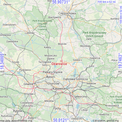
Ożarowice GPS coordinates[2]
50° 27' 42.552" North, 19° 2' 35.412" East
| Map corner | latitude | longitude |
|---|---|---|
| Upper-left | 50.90731°, | 18.34005° |
| Center: | 50.46182°, | 19.04317° |
| Lower-right: | 50.0121°, | 19.7463° |
| Map W x H: | 99.5×99.5 km | = 61.8×61.8mi |
| max Lat: | 54.83135° ⇑68% North |
| Ożarowice: | 50.46182° |
| min Lat: | ⇓32% South 49.21328° |
| min Long | Ożarowice | max Long |
| 14.20249° | 19.04317° | 24.03723° |
| W 40.7%⇐ | ⇒59.3% E |
Elevation
Elevation of Ożarowice is 292 m = 958 ft, and this is 100.6 m = 330 ft above average elevation for this country.
| Max E: |
974 m = 3196 ft | 14.6% |
| Ożarowice | 292 m 958 ft | |
| Avg. | 191.4 m = 628 ft | |
Min E: |
-3 m = -10 ft | 85.4% |
See also: Poland elevation on elevation.city.
Geographical zone
Ożarowice is located in North temperate zone (between Tropic of Cancer and the Arctic Circle). Distance of this North polar circle is 1790.3 km =1112.4 mi to North.| Distance of | km | miles | from Ożarowice |
|---|---|---|---|
| North Pole | 4396.2 | 2731.7 | to North |
| Arctic Circle | 1790.3 | 1112.4 | to North |
| Tropic Cancer | 3004.9 | 1867.2 | to South |
| Equator | 5610.8 | 3486.4 | to South |


Nearby cities:
15 places around Ożarowice: (largest is in red/bold)
• Bobrowniki
10 km =6.2 mi,  203°
203°
• Dobieszowice
7.5 km =4.7 mi, 196°
• Gródków
11.9 km =7.4 mi,  158°
158°
• Miasteczko Śląskie
8.6 km =5.3 mi,  301°
301°
• Mierzęcice
6.4 km =4 mi,  107°
107°
• Nakło
9.8 km =6.1 mi,  253°
253°
• Orzech
9.3 km =5.8 mi, 245°
• Psary
10.5 km =6.5 mi,  150°
150°
• Radzionków
12.1 km =7.5 mi,  235°
235°
• Rogoźnik
7.9 km =4.9 mi,  182°
182°
• Strzyżowice
8.7 km =5.4 mi, 162°
• Sączów
3.1 km =1.9 mi, 197°
• Wojkowice
10.8 km =6.7 mi, 182°
• Wymysłów
6.9 km =4.3 mi,  215°
215°
• Świerklaniec
7.8 km =4.8 mi, 253°
Sources, notices
• [Note1] Compared only with cities in Poland existing in our database
• [Src1] Map data: © OpenStreetMap contributors (CC-BY-SA)
• [Src2] Other city data from geonames.org with taken over terms of usage.
• [Src3] Geographical zone / Annual Mean Temperature by Robert A. Rohde @ Wikipedia
