Nowogród Bobrzański geodata
Nowogród Bobrzański (Lubusz) is a seat of a third-order administrative division; located in Poland in Europe/Warsaw (GMT+2) time zone. With population of 5,114 people, there are 677 cities with bigger population in this country. Compared to other cities in Poland, 62.1% of cities are located further ↓South; 96.7% of cities are located further →East and 88.1% of cities have higher elevation than Nowogród Bobrzański. Note1
Administrative division(s):
- Level 1: Lubusz
- Level 2: Powiat zielonogórski
- Level 3: Nowogród Bobrzański


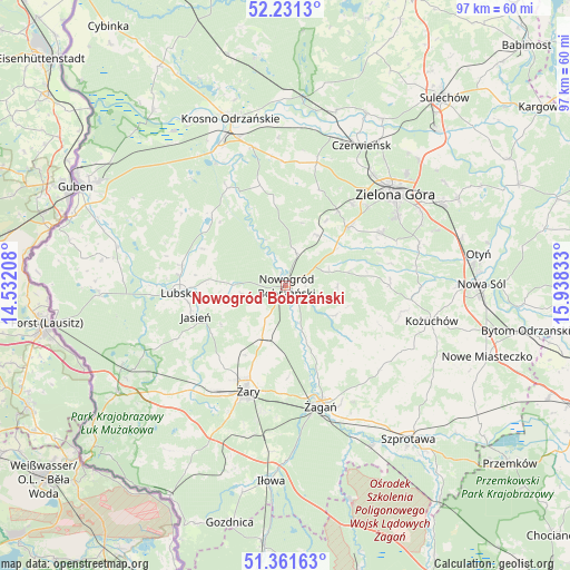
Nowogród Bobrzański GPS coordinates[2]
51° 47' 54.816" North, 15° 14' 6.72" East
| Map corner | latitude | longitude |
|---|---|---|
| Upper-left | 52.2313°, | 14.53208° |
| Center: | 51.79856°, | 15.2352° |
| Lower-right: | 51.36163°, | 15.93833° |
| Map W x H: | 96.7×96.7 km | = 60.1×60.1mi |
| max Lat: | 54.83135° ⇑37.9% North |
| Nowogród Bobrzański: | 51.79856° |
| min Lat: | ⇓62.1% South 49.21328° |
| min Long | Nowogród Bobrz | max Long |
| 14.20249° | 15.2352° | 24.03723° |
| W 3.3%⇐ | ⇒96.7% E |
Elevation
Elevation of Nowogród Bobrzański is 81 m = 266 ft, and this is 110.4 m = 362 ft below average elevation for this country.
| Max E: |
974 m = 3196 ft | 88.1% |
| Avg. | 191.4 m = 628 ft | |
| Nowogród Bobrzański | 81 m = 266 ft | |
Min E: |
-3 m = -10 ft | 11.9% |
See also: Poland elevation on elevation.city.
Geographical zone
Nowogród Bobrzański is located in North temperate zone (between Tropic of Cancer and the Arctic Circle). Distance of this North polar circle is 1641.7 km =1020.1 mi to North.| Distance of | km | miles | from Nowogród Bobrzański |
|---|---|---|---|
| North Pole | 4247.6 | 2639.3 | to North |
| Arctic Circle | 1641.7 | 1020.1 | to North |
| Tropic Cancer | 3153.5 | 1959.5 | to South |
| Equator | 5759.5 | 3578.8 | to South |


Nearby cities:
15 places around Nowogród Bobrzański: (largest is in red/bold)
• Bobrowice
19.4 km =12.1 mi,  329°
329°
• Brzeźnica
14.4 km =8.9 mi,  130°
130°
• Jasień
16.1 km =10 mi,  250°
250°
• Kaczeniec
7.9 km =4.9 mi,  67°
67°
• Kunice Żarskie
22.7 km =14.1 mi,  192°
192°
• Lipinki Łużyckie
24 km =14.9 mi,  222°
222°
• Lubsko
18.2 km =11.3 mi,  265°
265°
• Niwiska
11 km =6.8 mi,  77°
77°
• Ochla
18.5 km =11.5 mi,  61°
61°
• Ploty
24.1 km =15 mi,  30°
30°
• Sieniawa Żarska
21.3 km =13.2 mi,  214°
214°
• Zielona Góra
24.1 km =15 mi,  50°
50°
• Świdnica
14.6 km =9.1 mi, 46°
• Żagań
20.9 km =13 mi,  164°
164°
• Żary
18.7 km =11.6 mi,  201°
201°
Sources, notices
• [Note1] Compared only with cities in Poland existing in our database
• [Src1] Map data: © OpenStreetMap contributors (CC-BY-SA)
• [Src2] Other city data from geonames.org with taken over terms of usage.
• [Src3] Geographical zone / Annual Mean Temperature by Robert A. Rohde @ Wikipedia
