Niwiska geodata
Niwiska (Lubusz) is a populated place; located in Poland in Europe/Warsaw (GMT+2) time zone. With population of 800 people, there are 2851 cities with bigger population in this country. Compared to other cities in Poland, 62.4% of cities are located further ↓South; 96% of cities are located further →East and 87.8% of cities have higher elevation than Niwiska. Note1
Administrative division(s):
- Level 1: Lubusz
- Level 2: Powiat zielonogórski
- Level 3: Nowogród Bobrzański


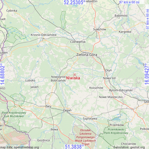
Niwiska GPS coordinates[2]
51° 49' 13.872" North, 15° 23' 28.104" East
| Map corner | latitude | longitude |
|---|---|---|
| Upper-left | 52.25305°, | 14.68802° |
| Center: | 51.82052°, | 15.39114° |
| Lower-right: | 51.3838°, | 16.09427° |
| Map W x H: | 96.7×96.6 km | = 60.1×60mi |
| max Lat: | 54.83135° ⇑37.6% North |
| Niwiska: | 51.82052° |
| min Lat: | ⇓62.4% South 49.21328° |
| min Long | Niwiska | max Long |
| 14.20249° | 15.39114° | 24.03723° |
| W 4%⇐ | ⇒96% E |
Elevation
Elevation of Niwiska is 82 m = 269 ft, and this is 109.4 m = 359 ft below average elevation for this country.
| Max E: |
974 m = 3196 ft | 87.8% |
| Avg. | 191.4 m = 628 ft | |
| Niwiska | 82 m = 269 ft | |
Min E: |
-3 m = -10 ft | 12.2% |
See also: Poland elevation on elevation.city.
Geographical zone
Niwiska is located in North temperate zone (between Tropic of Cancer and the Arctic Circle). Distance of this North polar circle is 1639.3 km =1018.6 mi to North.| Distance of | km | miles | from Niwiska |
|---|---|---|---|
| North Pole | 4245.2 | 2637.8 | to North |
| Arctic Circle | 1639.3 | 1018.6 | to North |
| Tropic Cancer | 3156 | 1961 | to South |
| Equator | 5761.9 | 3580.3 | to South |


Nearby cities:
15 places around Niwiska: (largest is in red/bold)
• Bobrowice
25.1 km =15.6 mi,  304°
304°
• Bobrowniki
23.9 km =14.9 mi,  78°
78°
• Brzeźnica
11.8 km =7.3 mi,  179°
179°
• Czerwieńsk
21.5 km =13.4 mi,  5°
5°
• Kaczeniec
3.5 km =2.2 mi,  279°
279°
• Kożuchów
16.3 km =10.1 mi,  120°
120°
• Nowa Sól
22.5 km =14 mi,  94°
94°
• Nowogród Bobrzański
11 km =6.8 mi,  257°
257°
• Ochla
8.5 km =5.3 mi,  40°
40°
• Otyń
22.2 km =13.8 mi, 82°
• Ploty
18.4 km =11.4 mi,  4°
4°
• Przyborów
26.1 km =16.2 mi,  95°
95°
• Zielona Góra
15 km =9.3 mi,  31°
31°
• Świdnica
7.5 km =4.7 mi,  359°
359°
• Żagań
23.2 km =14.4 mi,  193°
193°
Sources, notices
• [Note1] Compared only with cities in Poland existing in our database
• [Src1] Map data: © OpenStreetMap contributors (CC-BY-SA)
• [Src2] Other city data from geonames.org with taken over terms of usage.
• [Src3] Geographical zone / Annual Mean Temperature by Robert A. Rohde @ Wikipedia
