Nowe Miasto nad Wartą geodata
Nowe Miasto nad Wartą (Greater Poland) is a populated place; located in Poland in Europe/Warsaw (GMT+2) time zone. With population of 1,543 people, there are 1809 cities with bigger population in this country. Compared to other cities in Poland, 67.6% of cities are located further ↓South; 80.6% of cities are located further →East and 89.9% of cities have higher elevation than Nowe Miasto nad Wartą. Note1
Administrative division(s):
- Level 1: Greater Poland
- Level 2: Powiat średzki
- Level 3: Nowe Miasto nad Wartą
Current local time in Nowe Miasto nad Wartą:
06:45 AM, SaturdayDifference from your time zone: hours


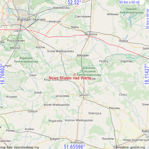
Nowe Miasto nad Wartą GPS coordinates[2]
52° 5' 24.252" North, 17° 24' 40.104" East
| Map corner | latitude | longitude |
|---|---|---|
| Upper-left | 52.52°, | 16.70802° |
| Center: | 52.09007°, | 17.41114° |
| Lower-right: | 51.65596°, | 18.11427° |
| Map W x H: | 96.1×96.1 km | = 59.7×59.7mi |
| max Lat: | 54.83135° ⇑32.4% North |
| Nowe Miasto nad Wartą: | 52.09007° |
| min Lat: | ⇓67.6% South 49.21328° |
| min Long | Nowe Miasto nad | max Long |
| 14.20249° | 17.41114° | 24.03723° |
| W 19.4%⇐ | ⇒80.6% E |
Elevation
Elevation of Nowe Miasto nad Wartą is 76 m = 249 ft, and this is 115.4 m = 379 ft below average elevation for this country.
| Max E: |
974 m = 3196 ft | 89.9% |
| Avg. | 191.4 m = 628 ft | |
| Nowe Miasto nad Wartą | 76 m = 249 ft | |
Min E: |
-3 m = -10 ft | 10.1% |
See also: Poland elevation on elevation.city.
Geographical zone
Nowe Miasto nad Wartą is located in North temperate zone (between Tropic of Cancer and the Arctic Circle). Distance of this North polar circle is 1609.3 km =1000 mi to North.| Distance of | km | miles | from Nowe Miasto nad Wartą |
|---|---|---|---|
| North Pole | 4215.2 | 2619.2 | to North |
| Arctic Circle | 1609.3 | 1000 | to North |
| Tropic Cancer | 3186 | 1979.7 | to South |
| Equator | 5791.9 | 3598.9 | to South |


Nearby cities:
15 places around Nowe Miasto nad Wartą: (largest is in red/bold)
• Dobieszczyzna
19.2 km =11.9 mi,  111°
111°
• Golina
20.1 km =12.5 mi,  165°
165°
• Jaraczewo
15.6 km =9.7 mi,  210°
210°
• Jarocin
14.5 km =9 mi,  154°
154°
• Kołaczkowo
20.3 km =12.6 mi,  45°
45°
• Krzykosy
3.4 km =2.1 mi,  311°
311°
• Książ Wielkopolski
12.1 km =7.5 mi,  254°
254°
• Lisewo
19.3 km =12 mi,  92°
92°
• Miłosław
13.7 km =8.5 mi,  23°
23°
• Solec
5.9 km =3.7 mi,  288°
288°
• Słupia Wiełka
19.3 km =12 mi,  317°
317°
• Witaszyce
19.5 km =12.1 mi, 148°
• Zaniemyśl
18.5 km =11.5 mi, 293°
• Środa Wielkopolska
17.9 km =11.1 mi,  329°
329°
• Żerków
10.7 km =6.6 mi,  102°
102°
Sources, notices
• [Note1] Compared only with cities in Poland existing in our database
• [Src1] Map data: © OpenStreetMap contributors (CC-BY-SA)
• [Src2] Other city data from geonames.org with taken over terms of usage.
• [Src3] Geographical zone / Annual Mean Temperature by Robert A. Rohde @ Wikipedia
