Niechanowo geodata
Niechanowo (Greater Poland) is a seat of a third-order administrative division; located in Poland in Europe/Warsaw (GMT+2) time zone. With population of 2,300 people, there are 1321 cities with bigger population in this country. Compared to other cities in Poland, 75.8% of cities are located further ↓South; 78.5% of cities are located further →East and 69.8% of cities have higher elevation than Niechanowo. Note1
Administrative division(s):
- Level 1: Greater Poland
- Level 2: Powiat gnieźnieński
- Level 3: Niechanowo


Niechanowo GPS coordinates[2]
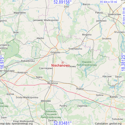
52° 27' 54.972" North, 17° 40' 41.232" East
| Map corner | latitude | longitude |
|---|---|---|
| Upper-left | 52.89156°, | 16.975° |
| Center: | 52.46527°, | 17.67812° |
| Lower-right: | 52.03481°, | 18.38125° |
| Map W x H: | 95.3×95.3 km | = 59.2×59.2mi |
| max Lat: | 54.83135° ⇑24.2% North |
| Niechanowo: | 52.46527° |
| min Lat: | ⇓75.8% South 49.21328° |
| min Long | Niechanowo | max Long |
| 14.20249° | 17.67812° | 24.03723° |
| W 21.5%⇐ | ⇒78.5% E |
Elevation
Elevation of Niechanowo is 121 m = 397 ft, and this is 70.4 m = 231 ft below average elevation for this country.
| Max E: |
974 m = 3196 ft | 69.8% |
| Avg. | 191.4 m = 628 ft | |
| Niechanowo | 121 m = 397 ft | |
Min E: |
-3 m = -10 ft | 30.2% |
See also: Poland elevation on elevation.city.
Geographical zone
Niechanowo is located in North temperate zone (between Tropic of Cancer and the Arctic Circle). Distance of this North polar circle is 1567.6 km =974.1 mi to North.| Distance of | km | miles | from Niechanowo |
|---|---|---|---|
| North Pole | 4173.5 | 2593.3 | to North |
| Arctic Circle | 1567.6 | 974.1 | to North |
| Tropic Cancer | 3227.7 | 2005.6 | to South |
| Equator | 5833.6 | 3624.8 | to South |


Nearby cities:
15 places around Niechanowo: (largest is in red/bold)
• Czerniejewo
13.5 km =8.4 mi,  251°
251°
• Gniezno
10.1 km =6.3 mi,  320°
320°
• Grabowo Królewskie
25.2 km =15.7 mi,  188°
188°
• Kłecko
25 km =15.5 mi, 317°
• Mieleszyn
25.7 km =16 mi,  331°
331°
• Nekla
21.1 km =13.1 mi,  238°
238°
• Orchowo
23.4 km =14.5 mi,  77°
77°
• Powidz
17.3 km =10.7 mi,  109°
109°
• Sokolniki
23.8 km =14.8 mi,  175°
175°
• Strzałkowo
20 km =12.4 mi,  151°
151°
• Słupca
23.8 km =14.8 mi, 146°
• Trzemeszno
14.5 km =9 mi,  42°
42°
• Witkowo
7 km =4.3 mi, 113°
• Września
17.4 km =10.8 mi,  206°
206°
• Łubowo
16.1 km =10 mi,  288°
288°
Sources, notices
• [Note1] Compared only with cities in Poland existing in our database
• [Src1] Map data: © OpenStreetMap contributors (CC-BY-SA)
• [Src2] Other city data from geonames.org with taken over terms of usage.
• [Src3] Geographical zone / Annual Mean Temperature by Robert A. Rohde @ Wikipedia
