Września geodata
Września (Greater Poland) is a seat of a second-order administrative division; located in Poland in Europe/Warsaw (GMT+2) time zone. With population of 28,703 people, there are 172 cities with bigger population in this country. Compared to other cities in Poland, 73.2% of cities are located further ↓South; 79.3% of cities are located further →East and 76.9% of cities have higher elevation than Września. Note1


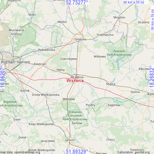
Września GPS coordinates[2]
52° 19' 30.432" North, 17° 33' 54.684" East
| Map corner | latitude | longitude |
|---|---|---|
| Upper-left | 52.75277°, | 16.86207° |
| Center: | 52.32512°, | 17.56519° |
| Lower-right: | 51.89329°, | 18.26832° |
| Map W x H: | 95.6×95.6 km | = 59.4×59.4mi |
| max Lat: | 54.83135° ⇑26.8% North |
| Września: | 52.32512° |
| min Lat: | ⇓73.2% South 49.21328° |
| min Long | Września | max Long |
| 14.20249° | 17.56519° | 24.03723° |
| W 20.7%⇐ | ⇒79.3% E |
Elevation
Elevation of Września is 106 m = 348 ft, and this is 85.4 m = 280 ft below average elevation for this country.
| Max E: |
974 m = 3196 ft | 76.9% |
| Avg. | 191.4 m = 628 ft | |
| Września | 106 m = 348 ft | |
Min E: |
-3 m = -10 ft | 23.1% |
See also: Poland elevation on elevation.city.
Geographical zone
Września is located in North temperate zone (between Tropic of Cancer and the Arctic Circle). Distance of this North polar circle is 1583.2 km =983.8 mi to North.| Distance of | km | miles | from Września |
|---|---|---|---|
| North Pole | 4189.1 | 2603 | to North |
| Arctic Circle | 1583.2 | 983.8 | to North |
| Tropic Cancer | 3212.1 | 1995.9 | to South |
| Equator | 5818 | 3615.1 | to South |


Nearby cities:
15 places around Września: (largest is in red/bold)
• Czerniejewo
12.4 km =7.7 mi,  335°
335°
• Dominowo
14.6 km =9.1 mi,  255°
255°
• Gniezno
23.3 km =14.5 mi,  2°
2°
• Grabowo Królewskie
10 km =6.2 mi,  157°
157°
• Kołaczkowo
12.6 km =7.8 mi, 161°
• Miłosław
14.5 km =9 mi,  200°
200°
• Nekla
11.2 km =7 mi,  293°
293°
• Niechanowo
17.4 km =10.8 mi,  26°
26°
• Pyzdry
19.2 km =11.9 mi,  153°
153°
• Sokolniki
12.6 km =7.8 mi,  130°
130°
• Strzałkowo
17.3 km =10.7 mi,  96°
96°
• Słupca
21.3 km =13.2 mi, 101°
• Witkowo
19 km =11.8 mi,  47°
47°
• Łubowo
22.1 km =13.7 mi, 339°
• Środa Wielkopolska
22.4 km =13.9 mi,  241°
241°
Sources, notices
• [Note1] Compared only with cities in Poland existing in our database
• [Src1] Map data: © OpenStreetMap contributors (CC-BY-SA)
• [Src2] Other city data from geonames.org with taken over terms of usage.
• [Src3] Geographical zone / Annual Mean Temperature by Robert A. Rohde @ Wikipedia
