Raciąż geodata
Raciąż (Kujawsko-Pomorskie) is a populated place; located in Poland in Europe/Warsaw (GMT+2) time zone. With population of 756 people, there are 2939 cities with bigger population in this country. Compared to other cities in Poland, 91.1% of cities are located further ↓South; 77.3% of cities are located further →East and 69.3% of cities have higher elevation than Raciąż. Note1


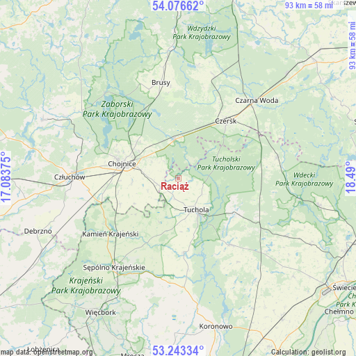
Raciąż GPS coordinates[2]
53° 39' 43.344" North, 17° 47' 12.732" East
| Map corner | latitude | longitude |
|---|---|---|
| Upper-left | 54.07662°, | 17.08375° |
| Center: | 53.66204°, | 17.78687° |
| Lower-right: | 53.24334°, | 18.49° |
| Map W x H: | 92.7×92.6 km | = 57.6×57.5mi |
| max Lat: | 54.83135° ⇑8.9% North |
| Raciąż: | 53.66204° |
| min Lat: | ⇓91.1% South 49.21328° |
| min Long | Raciąż | max Long |
| 14.20249° | 17.78687° | 24.03723° |
| W 22.7%⇐ | ⇒77.3% E |
Elevation
Elevation of Raciąż is 122 m = 400 ft, and this is 69.4 m = 228 ft below average elevation for this country.
| Max E: |
974 m = 3196 ft | 69.3% |
| Avg. | 191.4 m = 628 ft | |
| Raciąż | 122 m = 400 ft | |
Min E: |
-3 m = -10 ft | 30.7% |
See also: Poland elevation on elevation.city.
Geographical zone
Raciąż is located in North temperate zone (between Tropic of Cancer and the Arctic Circle). Distance of this North polar circle is 1434.5 km =891.4 mi to North.| Distance of | km | miles | from Raciąż |
|---|---|---|---|
| North Pole | 4040.4 | 2510.6 | to North |
| Arctic Circle | 1434.5 | 891.4 | to North |
| Tropic Cancer | 3360.7 | 2088.2 | to South |
| Equator | 5966.7 | 3707.5 | to South |


Nearby cities:
15 places around Raciąż: (largest is in red/bold)
• Brusy
25.1 km =15.6 mi,  349°
349°
• Cekcyn
17.8 km =11.1 mi,  123°
123°
• Chojnice
15.6 km =9.7 mi,  283°
283°
• Czersk
19.4 km =12.1 mi,  39°
39°
• Człuchów
28.2 km =17.5 mi,  271°
271°
• Gostycyn
19.2 km =11.9 mi,  175°
175°
• Kamienica
20.4 km =12.7 mi, 175°
• Kamień Krajeński
22.7 km =14.1 mi,  230°
230°
• Karsin
28.7 km =17.8 mi,  17°
17°
• Kęsowo
12.4 km =7.7 mi,  202°
202°
• Lubiewo
27.1 km =16.8 mi,  143°
143°
• Ostrowite
8.5 km =5.3 mi,  247°
247°
• Szlachta
24.5 km =15.2 mi,  61°
61°
• Tuchola
9.5 km =5.9 mi,  149°
149°
• Śliwice
26 km =16.2 mi,  78°
78°
Sources, notices
• [Note1] Compared only with cities in Poland existing in our database
• [Src1] Map data: © OpenStreetMap contributors (CC-BY-SA)
• [Src2] Other city data from geonames.org with taken over terms of usage.
• [Src3] Geographical zone / Annual Mean Temperature by Robert A. Rohde @ Wikipedia
