Dobrzyń nad Wisłą geodata
Dobrzyń nad Wisłą (Kujawsko-Pomorskie) is a seat of a third-order administrative division; located in Poland in Europe/Warsaw (GMT+2) time zone. With population of 2,268 people, there are 1333 cities with bigger population in this country. Compared to other cities in Poland, 78.5% of cities are located further ↓South; 54.1% of cities are located further →East and 81.2% of cities have higher elevation than Dobrzyń nad Wisłą. Note1
Administrative division(s):
- Level 1: Kujawsko-Pomorskie
- Level 2: Powiat lipnowski
- Level 3: Dobrzyń nad Wisłą


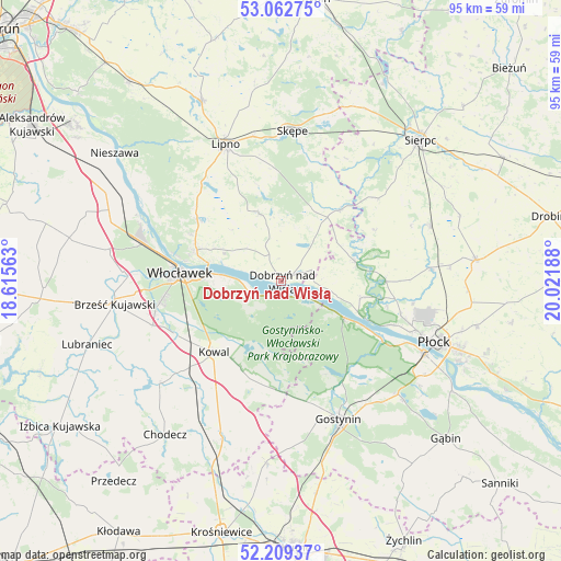
Dobrzyń nad Wisłą GPS coordinates[2]
52° 38' 17.304" North, 19° 19' 7.5" East
| Map corner | latitude | longitude |
|---|---|---|
| Upper-left | 53.06275°, | 18.61563° |
| Center: | 52.63814°, | 19.31875° |
| Lower-right: | 52.20937°, | 20.02188° |
| Map W x H: | 94.9×94.9 km | = 59×59mi |
| max Lat: | 54.83135° ⇑21.5% North |
| Dobrzyń nad Wisłą: | 52.63814° |
| min Lat: | ⇓78.5% South 49.21328° |
| min Long | Dobrzyń nad Wi | max Long |
| 14.20249° | 19.31875° | 24.03723° |
| W 45.9%⇐ | ⇒54.1% E |
Elevation
Elevation of Dobrzyń nad Wisłą is 97 m = 318 ft, and this is 94.4 m = 310 ft below average elevation for this country.
| Max E: |
974 m = 3196 ft | 81.2% |
| Avg. | 191.4 m = 628 ft | |
| Dobrzyń nad Wisłą | 97 m = 318 ft | |
Min E: |
-3 m = -10 ft | 18.8% |
See also: Poland elevation on elevation.city.
Geographical zone
Dobrzyń nad Wisłą is located in North temperate zone (between Tropic of Cancer and the Arctic Circle). Distance of this North polar circle is 1548.4 km =962.1 mi to North.| Distance of | km | miles | from Dobrzyń nad Wisłą |
|---|---|---|---|
| North Pole | 4154.2 | 2581.3 | to North |
| Arctic Circle | 1548.4 | 962.1 | to North |
| Tropic Cancer | 3246.9 | 2017.5 | to South |
| Equator | 5852.8 | 3636.8 | to South |


Nearby cities:
15 places around Dobrzyń nad Wisłą: (largest is in red/bold)
• Baruchowo
16.4 km =10.2 mi,  192°
192°
• Biała
22.6 km =14 mi,  99°
99°
• Brudzeń Duży
13 km =8.1 mi,  74°
74°
• Czerniewice
21.1 km =13.1 mi,  228°
228°
• Fabianki
16.7 km =10.4 mi,  302°
302°
• Gostynin
25.2 km =15.7 mi,  157°
157°
• Kowal
16.7 km =10.4 mi,  223°
223°
• Lipno
24.8 km =15.4 mi,  337°
337°
• Maszewo Duże
21.9 km =13.6 mi,  107°
107°
• Mochowo
21.4 km =13.3 mi,  48°
48°
• Nowy Duninów
12.5 km =7.8 mi,  119°
119°
• Tłuchowo
15.6 km =9.7 mi,  39°
39°
• Wielgie
12 km =7.5 mi, 341°
• Witkowo
16.5 km =10.3 mi,  325°
325°
• Włocławek
17 km =10.6 mi,  273°
273°
Sources, notices
• [Note1] Compared only with cities in Poland existing in our database
• [Src1] Map data: © OpenStreetMap contributors (CC-BY-SA)
• [Src2] Other city data from geonames.org with taken over terms of usage.
• [Src3] Geographical zone / Annual Mean Temperature by Robert A. Rohde @ Wikipedia
