Popielów geodata
Popielów (Opole Voivodeship) is a populated place; located in Poland in Europe/Warsaw (GMT+2) time zone. With population of 2,400 people, there are 1283 cities with bigger population in this country. Compared to other cities in Poland, 59.6% of cities are located further ↑North; 77.8% of cities are located further →East and 61.1% of cities have higher elevation than Popielów. Note1


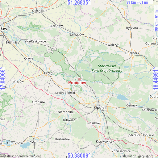
Popielów GPS coordinates[2]
50° 49' 34.752" North, 17° 44' 37.608" East
| Map corner | latitude | longitude |
|---|---|---|
| Upper-left | 51.26835°, | 17.04066° |
| Center: | 50.82632°, | 17.74378° |
| Lower-right: | 50.38006°, | 18.44691° |
| Map W x H: | 98.8×98.8 km | = 61.4×61.4mi |
| max Lat: | 54.83135° ⇑59.6% North |
| Popielów: | 50.82632° |
| min Lat: | ⇓40.4% South 49.21328° |
| min Long | Popielów | max Long |
| 14.20249° | 17.74378° | 24.03723° |
| W 22.2%⇐ | ⇒77.8% E |
Elevation
Elevation of Popielów is 144 m = 472 ft, and this is 47.4 m = 156 ft below average elevation for this country.
| Max E: |
974 m = 3196 ft | 61.1% |
| Avg. | 191.4 m = 628 ft | |
| Popielów | 144 m = 472 ft | |
Min E: |
-3 m = -10 ft | 38.9% |
See also: Poland elevation on elevation.city.
Geographical zone
Popielów is located in North temperate zone (between Tropic of Cancer and the Arctic Circle). Distance of this North polar circle is 1749.8 km =1087.3 mi to North.| Distance of | km | miles | from Popielów |
|---|---|---|---|
| North Pole | 4355.7 | 2706.5 | to North |
| Arctic Circle | 1749.8 | 1087.3 | to North |
| Tropic Cancer | 3045.4 | 1892.3 | to South |
| Equator | 5651.4 | 3511.6 | to South |


Nearby cities:
15 places around Popielów: (largest is in red/bold)
• Borkowice
9.7 km =6 mi,  191°
191°
• Chróścice
7 km =4.3 mi,  136°
136°
• Czarnowąsy
15.4 km =9.6 mi, 135°
• Dobrzeń Wielki
9.7 km =6 mi,  131°
131°
• Domaradz
16 km =9.9 mi,  32°
32°
• Dąbrowa
15.9 km =9.9 mi,  178°
178°
• Karczów
14 km =8.7 mi,  168°
168°
• Kup
10.1 km =6.3 mi,  102°
102°
• Lewin Brzeski
12.4 km =7.7 mi,  225°
225°
• Murów
14.7 km =9.1 mi,  73°
73°
• Pokój
10.7 km =6.6 mi,  37°
37°
• Skorogoszcz
8.6 km =5.3 mi,  210°
210°
• Swierkle
14.8 km =9.2 mi,  117°
117°
• Łosiów
13.1 km =8.1 mi,  252°
252°
• Świerczów
14.9 km =9.3 mi,  4°
4°
Sources, notices
• [Note1] Compared only with cities in Poland existing in our database
• [Src1] Map data: © OpenStreetMap contributors (CC-BY-SA)
• [Src2] Other city data from geonames.org with taken over terms of usage.
• [Src3] Geographical zone / Annual Mean Temperature by Robert A. Rohde @ Wikipedia
