Dąbrowa Zielona geodata
Dąbrowa Zielona (Silesia) is a seat of a third-order administrative division; located in Poland in Europe/Warsaw (GMT+2) time zone. With population of 881 people, there are 2710 cities with bigger population in this country. Compared to other cities in Poland, 59.3% of cities are located further ↑North; 50.2% of cities are located further →East and 75.5% of cities have lower elevation than Dąbrowa Zielona. Note1


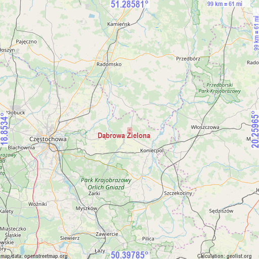
Dąbrowa Zielona GPS coordinates[2]
50° 50' 38.184" North, 19° 33' 23.472" East
| Map corner | latitude | longitude |
|---|---|---|
| Upper-left | 51.28581°, | 18.8534° |
| Center: | 50.84394°, | 19.55652° |
| Lower-right: | 50.39785°, | 20.25965° |
| Map W x H: | 98.7×98.7 km | = 61.3×61.3mi |
| max Lat: | 54.83135° ⇑59.3% North |
| Dąbrowa Zielona: | 50.84394° |
| min Lat: | ⇓40.7% South 49.21328° |
| min Long | Dąbrowa Zielon | max Long |
| 14.20249° | 19.55652° | 24.03723° |
| W 49.8%⇐ | ⇒50.2% E |
Elevation
Elevation of Dąbrowa Zielona is 248 m = 814 ft, and this is 56.6 m = 186 ft above average elevation for this country.
| Max E: |
974 m = 3196 ft | 24.5% |
| Dąbrowa Zielona | 248 m 814 ft | |
| Avg. | 191.4 m = 628 ft | |
Min E: |
-3 m = -10 ft | 75.5% |
See also: Poland elevation on elevation.city.
Geographical zone
Dąbrowa Zielona is located in North temperate zone (between Tropic of Cancer and the Arctic Circle). Distance of this North polar circle is 1747.9 km =1086.1 mi to North.| Distance of | km | miles | from Dąbrowa Zielona |
|---|---|---|---|
| North Pole | 4353.7 | 2705.3 | to North |
| Arctic Circle | 1747.9 | 1086.1 | to North |
| Tropic Cancer | 3047.4 | 1893.6 | to South |
| Equator | 5653.3 | 3512.8 | to South |


Nearby cities:
15 places around Dąbrowa Zielona: (largest is in red/bold)
• Drochlin
14 km =8.7 mi,  155°
155°
• Dąbrowno
19.2 km =11.9 mi,  183°
183°
• Gidle
14.4 km =8.9 mi,  335°
335°
• Janów
16 km =9.9 mi,  212°
212°
• Koniecpol
12.1 km =7.5 mi,  129°
129°
• Kłomnice
16.5 km =10.3 mi,  301°
301°
• Lelów
18.5 km =11.5 mi, 164°
• Mstów
19.1 km =11.9 mi,  265°
265°
• Potok Złoty
17.6 km =10.9 mi, 210°
• Przyrów
5.2 km =3.2 mi,  202°
202°
• Pławno
16.5 km =10.3 mi,  334°
334°
• Secemin
21.4 km =13.3 mi,  113°
113°
• Siedlec
21.5 km =13.4 mi,  218°
218°
• Soborzyce
4.5 km =2.8 mi,  67°
67°
• Żytno
10.5 km =6.5 mi,  28°
28°
Sources, notices
• [Note1] Compared only with cities in Poland existing in our database
• [Src1] Map data: © OpenStreetMap contributors (CC-BY-SA)
• [Src2] Other city data from geonames.org with taken over terms of usage.
• [Src3] Geographical zone / Annual Mean Temperature by Robert A. Rohde @ Wikipedia
