Soborzyce geodata
Soborzyce (Silesia) is a populated place; located in Poland in Europe/Warsaw (GMT+2) time zone. With population of 795 people, there are 2870 cities with bigger population in this country. Compared to other cities in Poland, 58.9% of cities are located further ↑North; 51.1% of cities are located further ←West and 73.4% of cities have lower elevation than Soborzyce. Note1


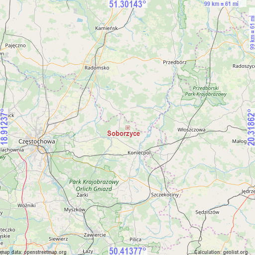
Soborzyce GPS coordinates[2]
50° 51' 34.956" North, 19° 36' 55.764" East
| Map corner | latitude | longitude |
|---|---|---|
| Upper-left | 51.30143°, | 18.91237° |
| Center: | 50.85971°, | 19.61549° |
| Lower-right: | 50.41377°, | 20.31862° |
| Map W x H: | 98.7×98.7 km | = 61.3×61.3mi |
| max Lat: | 54.83135° ⇑58.9% North |
| Soborzyce: | 50.85971° |
| min Lat: | ⇓41.1% South 49.21328° |
| min Long | Soborzyce | max Long |
| 14.20249° | 19.61549° | 24.03723° |
| W 51.1%⇐ | ⇒48.9% E |
Elevation
Elevation of Soborzyce is 241 m = 791 ft, and this is 49.6 m = 163 ft above average elevation for this country.
| Max E: |
974 m = 3196 ft | 26.6% |
| Soborzyce | 241 m 791 ft | |
| Avg. | 191.4 m = 628 ft | |
Min E: |
-3 m = -10 ft | 73.4% |
See also: Poland elevation on elevation.city.
Geographical zone
Soborzyce is located in North temperate zone (between Tropic of Cancer and the Arctic Circle). Distance of this North polar circle is 1746.1 km =1085 mi to North.| Distance of | km | miles | from Soborzyce |
|---|---|---|---|
| North Pole | 4352 | 2704.2 | to North |
| Arctic Circle | 1746.1 | 1085 | to North |
| Tropic Cancer | 3049.2 | 1894.7 | to South |
| Equator | 5655.1 | 3513.9 | to South |


Nearby cities:
15 places around Soborzyce: (largest is in red/bold)
• Drochlin
14.6 km =9.1 mi,  173°
173°
• Dąbrowa Zielona
4.5 km =2.8 mi,  247°
247°
• Gidle
15.2 km =9.4 mi,  318°
318°
• Janów
19.9 km =12.4 mi,  220°
220°
• Kobiele Wielkie
19.9 km =12.4 mi,  1°
1°
• Koniecpol
10.8 km =6.7 mi,  151°
151°
• Kłomnice
19.4 km =12.1 mi,  290°
290°
• Lelów
19.6 km =12.2 mi,  177°
177°
• Potok Złoty
21.4 km =13.3 mi, 217°
• Przyrów
9 km =5.6 mi, 223°
• Psary
20.5 km =12.7 mi,  134°
134°
• Pławno
17.3 km =10.7 mi, 319°
• Secemin
18.6 km =11.6 mi,  123°
123°
• Wielgomłyny
20 km =12.4 mi,  31°
31°
• Żytno
7.6 km =4.7 mi,  6°
6°
Sources, notices
• [Note1] Compared only with cities in Poland existing in our database
• [Src1] Map data: © OpenStreetMap contributors (CC-BY-SA)
• [Src2] Other city data from geonames.org with taken over terms of usage.
• [Src3] Geographical zone / Annual Mean Temperature by Robert A. Rohde @ Wikipedia
