Chocznia geodata
Chocznia (Lesser Poland) is a populated place; located in Poland in Europe/Warsaw (GMT+2) time zone. With population of 5,510 people, there are 640 cities with bigger population in this country. Compared to other cities in Poland, 88.7% of cities are located further ↑North; 51.8% of cities are located further →East and 84.7% of cities have lower elevation than Chocznia. Note1


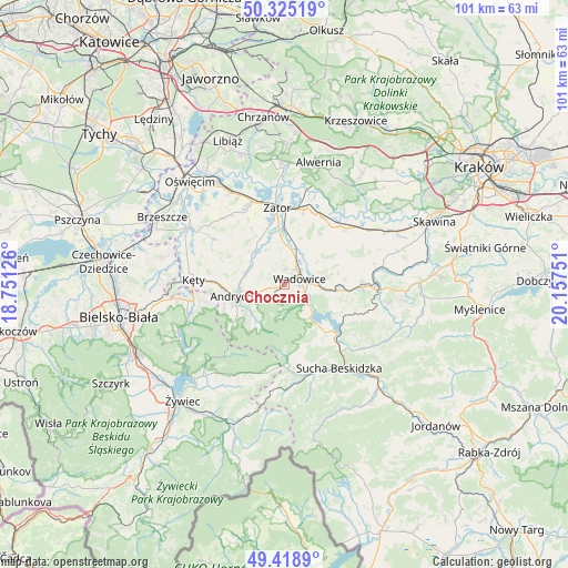
Chocznia GPS coordinates[2]
49° 52' 27.012" North, 19° 27' 15.768" East
| Map corner | latitude | longitude |
|---|---|---|
| Upper-left | 50.32519°, | 18.75126° |
| Center: | 49.87417°, | 19.45438° |
| Lower-right: | 49.4189°, | 20.15751° |
| Map W x H: | 100.8×100.8 km | = 62.6×62.6mi |
| max Lat: | 54.83135° ⇑88.7% North |
| Chocznia: | 49.87417° |
| min Lat: | ⇓11.3% South 49.21328° |
| min Long | Chocznia | max Long |
| 14.20249° | 19.45438° | 24.03723° |
| W 48.2%⇐ | ⇒51.8% E |
Elevation
Elevation of Chocznia is 288 m = 945 ft, and this is 96.6 m = 317 ft above average elevation for this country.
| Max E: |
974 m = 3196 ft | 15.3% |
| Chocznia | 288 m 945 ft | |
| Avg. | 191.4 m = 628 ft | |
Min E: |
-3 m = -10 ft | 84.7% |
See also: Poland elevation on elevation.city.
Geographical zone
Chocznia is located in North temperate zone (between Tropic of Cancer and the Arctic Circle). Distance of this North polar circle is 1855.7 km =1153.1 mi to North.| Distance of | km | miles | from Chocznia |
|---|---|---|---|
| North Pole | 4461.6 | 2772.3 | to North |
| Arctic Circle | 1855.7 | 1153.1 | to North |
| Tropic Cancer | 2939.6 | 1826.6 | to South |
| Equator | 5545.5 | 3445.8 | to South |


Nearby cities:
15 places around Chocznia: (largest is in red/bold)
• Frydrychowice
4.2 km =2.6 mi,  323°
323°
• Graboszyce
7.9 km =4.9 mi,  357°
357°
• Inwałd
4.6 km =2.9 mi,  255°
255°
• Jaroszowice
4.8 km =3 mi,  105°
105°
• Klecza Dolna
6 km =3.7 mi,  80°
80°
• Klecza Górna
7.4 km =4.6 mi,  98°
98°
• Ponikiew
4.6 km =2.9 mi,  169°
169°
• Radocza
5.1 km =3.2 mi,  16°
16°
• Tomice
3.4 km =2.1 mi,  38°
38°
• Wadowice
2.9 km =1.8 mi,  69°
69°
• Wieprz
7.2 km =4.5 mi,  284°
284°
• Witanowice
7.1 km =4.4 mi,  46°
46°
• Woźniki
7.5 km =4.7 mi, 20°
• Zagórnik
6.8 km =4.2 mi,  232°
232°
• Świnna Poręba
6.4 km =4 mi,  131°
131°
Sources, notices
• [Note1] Compared only with cities in Poland existing in our database
• [Src1] Map data: © OpenStreetMap contributors (CC-BY-SA)
• [Src2] Other city data from geonames.org with taken over terms of usage.
• [Src3] Geographical zone / Annual Mean Temperature by Robert A. Rohde @ Wikipedia
