Frydrychowice geodata
Frydrychowice (Lesser Poland) is a populated place; located in Poland in Europe/Warsaw (GMT+2) time zone. With population of 2,799 people, there are 1131 cities with bigger population in this country. Compared to other cities in Poland, 87.4% of cities are located further ↑North; 52.3% of cities are located further →East and 78.5% of cities have lower elevation than Frydrychowice. Note1


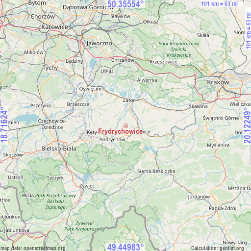
Frydrychowice GPS coordinates[2]
49° 54' 17.316" North, 19° 25' 9.696" East
| Map corner | latitude | longitude |
|---|---|---|
| Upper-left | 50.35554°, | 18.71624° |
| Center: | 49.90481°, | 19.41936° |
| Lower-right: | 49.44983°, | 20.12249° |
| Map W x H: | 100.7×100.7 km | = 62.6×62.6mi |
| max Lat: | 54.83135° ⇑87.4% North |
| Frydrychowice: | 49.90481° |
| min Lat: | ⇓12.6% South 49.21328° |
| min Long | Frydrychowice | max Long |
| 14.20249° | 19.41936° | 24.03723° |
| W 47.7%⇐ | ⇒52.3% E |
Elevation
Elevation of Frydrychowice is 259 m = 850 ft, and this is 67.6 m = 222 ft above average elevation for this country.
| Max E: |
974 m = 3196 ft | 21.5% |
| Frydrychowice | 259 m 850 ft | |
| Avg. | 191.4 m = 628 ft | |
Min E: |
-3 m = -10 ft | 78.5% |
See also: Poland elevation on elevation.city.
Geographical zone
Frydrychowice is located in North temperate zone (between Tropic of Cancer and the Arctic Circle). Distance of this North polar circle is 1852.3 km =1151 mi to North.| Distance of | km | miles | from Frydrychowice |
|---|---|---|---|
| North Pole | 4458.2 | 2770.2 | to North |
| Arctic Circle | 1852.3 | 1151 | to North |
| Tropic Cancer | 2943 | 1828.7 | to South |
| Equator | 5548.9 | 3447.9 | to South |


Nearby cities:
15 places around Frydrychowice: (largest is in red/bold)
• Andrychów
8 km =5 mi,  226°
226°
• Bachowice
8 km =5 mi,  41°
41°
• Chocznia
4.2 km =2.6 mi,  143°
143°
• Gierałtowice
4.8 km =3 mi,  334°
334°
• Graboszyce
5 km =3.1 mi,  25°
25°
• Inwałd
5 km =3.1 mi,  202°
202°
• Jaroszowice
8.6 km =5.3 mi,  123°
123°
• Nidek
6.8 km =4.2 mi,  270°
270°
• Radocza
4.2 km =2.6 mi,  70°
70°
• Tomice
4.7 km =2.9 mi,  99°
99°
• Wadowice
5.8 km =3.6 mi,  114°
114°
• Wieprz
4.7 km =2.9 mi,  250°
250°
• Witanowice
7.8 km =4.8 mi,  79°
79°
• Woźniki
6.3 km =3.9 mi,  54°
54°
• Zagórnik
8.1 km =5 mi, 201°
Sources, notices
• [Note1] Compared only with cities in Poland existing in our database
• [Src1] Map data: © OpenStreetMap contributors (CC-BY-SA)
• [Src2] Other city data from geonames.org with taken over terms of usage.
• [Src3] Geographical zone / Annual Mean Temperature by Robert A. Rohde @ Wikipedia
