Bytom Odrzański geodata
Bytom Odrzański (Lubusz) is a seat of a third-order administrative division; located in Poland in Europe/Warsaw (GMT+2) time zone. With population of 4,408 people, there are 749 cities with bigger population in this country. Compared to other cities in Poland, 60.8% of cities are located further ↓South; 93.4% of cities are located further →East and 88.1% of cities have higher elevation than Bytom Odrzański. Note1


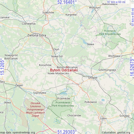
Bytom Odrzański GPS coordinates[2]
51° 43' 50.232" North, 15° 49' 25.032" East
| Map corner | latitude | longitude |
|---|---|---|
| Upper-left | 52.16401°, | 15.1205° |
| Center: | 51.73062°, | 15.82362° |
| Lower-right: | 51.29303°, | 16.52675° |
| Map W x H: | 96.8×96.8 km | = 60.1×60.1mi |
| max Lat: | 54.83135° ⇑39.2% North |
| Bytom Odrzański: | 51.73062° |
| min Lat: | ⇓60.8% South 49.21328° |
| min Long | Bytom Odrzańsk | max Long |
| 14.20249° | 15.82362° | 24.03723° |
| W 6.6%⇐ | ⇒93.4% E |
Elevation
Elevation of Bytom Odrzański is 81 m = 266 ft, and this is 110.4 m = 362 ft below average elevation for this country.
| Max E: |
974 m = 3196 ft | 88.1% |
| Avg. | 191.4 m = 628 ft | |
| Bytom Odrzański | 81 m = 266 ft | |
Min E: |
-3 m = -10 ft | 11.9% |
See also: Poland elevation on elevation.city.
Geographical zone
Bytom Odrzański is located in North temperate zone (between Tropic of Cancer and the Arctic Circle). Distance of this North polar circle is 1649.3 km =1024.8 mi to North.| Distance of | km | miles | from Bytom Odrzański |
|---|---|---|---|
| North Pole | 4255.2 | 2644.1 | to North |
| Arctic Circle | 1649.3 | 1024.8 | to North |
| Tropic Cancer | 3146 | 1954.8 | to South |
| Equator | 5751.9 | 3574.1 | to South |


Nearby cities:
15 places around Bytom Odrzański: (largest is in red/bold)
• Bielawy
9 km =5.6 mi,  61°
61°
• Bobrowniki
16.2 km =10.1 mi,  337°
337°
• Gaworzyce
12.1 km =7.5 mi,  160°
160°
• Głogów
19.5 km =12.1 mi,  112°
112°
• Kotla
14.7 km =9.1 mi,  83°
83°
• Kożuchów
15.8 km =9.8 mi,  276°
276°
• Kłobuczyn
14.8 km =9.2 mi,  149°
149°
• Lubięcin
18.1 km =11.2 mi,  11°
11°
• Niegosławice
17.6 km =10.9 mi,  205°
205°
• Nowa Sól
10.9 km =6.8 mi,  317°
317°
• Nowe Miasteczko
7.7 km =4.8 mi,  235°
235°
• Otyń
15.1 km =9.4 mi,  329°
329°
• Przyborów
8.6 km =5.3 mi, 333°
• Siedlisko
4.3 km =2.7 mi,  351°
351°
• Żukowice
12.8 km =8 mi,  120°
120°
In other languages:
- In German: Beuthen an Oder, Beuthen an der Oder, Beuthen
- In Russian: Бытом-Оджаньский
- In Chinese: 奧得河畔比托姆
Sources, notices
• [Note1] Compared only with cities in Poland existing in our database
• [Src1] Map data: © OpenStreetMap contributors (CC-BY-SA)
• [Src2] Other city data from geonames.org with taken over terms of usage.
• [Src3] Geographical zone / Annual Mean Temperature by Robert A. Rohde @ Wikipedia
