Nowa Sól geodata
Nowa Sól (Lubusz) is a seat of a second-order administrative division; located in Poland in Europe/Warsaw (GMT+2) time zone. With population of 40,354 people, there are 124 cities with bigger population in this country. Compared to other cities in Poland, 62.2% of cities are located further ↓South; 94.2% of cities are located further →East and 91.8% of cities have higher elevation than Nowa Sól. Note1


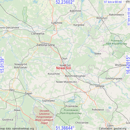
Nowa Sól GPS coordinates[2]
51° 48' 11.988" North, 15° 43' 1.272" East
| Map corner | latitude | longitude |
|---|---|---|
| Upper-left | 52.23602°, | 15.0139° |
| Center: | 51.80333°, | 15.71702° |
| Lower-right: | 51.36644°, | 16.42015° |
| Map W x H: | 96.7×96.7 km | = 60.1×60.1mi |
| max Lat: | 54.83135° ⇑37.8% North |
| Nowa Sól: | 51.80333° |
| min Lat: | ⇓62.2% South 49.21328° |
| min Long | Nowa Sól | max Long |
| 14.20249° | 15.71702° | 24.03723° |
| W 5.8%⇐ | ⇒94.2% E |
Elevation
Elevation of Nowa Sól is 66 m = 217 ft, and this is 125.4 m = 411 ft below average elevation for this country.
| Max E: |
974 m = 3196 ft | 91.8% |
| Avg. | 191.4 m = 628 ft | |
| Nowa Sól | 66 m = 217 ft | |
Min E: |
-3 m = -10 ft | 8.2% |
See also: Nowa Sól elevation on elevation.city.
Geographical zone
Nowa Sól is located in North temperate zone (between Tropic of Cancer and the Arctic Circle). Distance of this North polar circle is 1641.2 km =1019.8 mi to North.| Distance of | km | miles | from Nowa Sól |
|---|---|---|---|
| North Pole | 4247.1 | 2639 | to North |
| Arctic Circle | 1641.2 | 1019.8 | to North |
| Tropic Cancer | 3154.1 | 1959.9 | to South |
| Equator | 5760 | 3579.1 | to South |


Nearby cities:
15 places around Nowa Sól: (largest is in red/bold)
• Bielawy
15.7 km =9.8 mi,  104°
104°
• Bobrowniki
6.9 km =4.3 mi,  8°
8°
• Bojadła
17.9 km =11.1 mi,  21°
21°
• Bytom Odrzański
10.9 km =6.8 mi,  137°
137°
• Klenica
21.5 km =13.4 mi, 12°
• Konotop
19.2 km =11.9 mi,  41°
41°
• Kożuchów
10.6 km =6.6 mi,  232°
232°
• Lubięcin
14.6 km =9.1 mi,  48°
48°
• Nowe Miasteczko
12.5 km =7.8 mi,  175°
175°
• Ochla
18.9 km =11.7 mi,  296°
296°
• Otyń
4.9 km =3 mi,  355°
355°
• Przyborów
3.6 km =2.2 mi, 96°
• Siedlisko
7.7 km =4.8 mi,  120°
120°
• Zabór
16.5 km =10.3 mi, 359°
• Zielona Góra
20.6 km =12.8 mi,  315°
315°
Sources, notices
• [Note1] Compared only with cities in Poland existing in our database
• [Src1] Map data: © OpenStreetMap contributors (CC-BY-SA)
• [Src2] Other city data from geonames.org with taken over terms of usage.
• [Src3] Geographical zone / Annual Mean Temperature by Robert A. Rohde @ Wikipedia
