Bieżuń geodata
Bieżuń (Mazovia) is a seat of a third-order administrative division; located in Poland in Europe/Warsaw (GMT+2) time zone. With population of 1,931 people, there are 1534 cities with bigger population in this country. Compared to other cities in Poland, 83.1% of cities are located further ↓South; 56.7% of cities are located further ←West and 71.1% of cities have higher elevation than Bieżuń. Note1


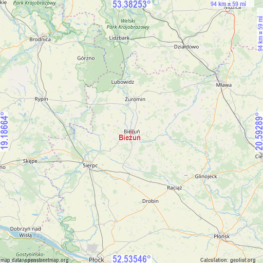
Bieżuń GPS coordinates[2]
52° 57' 39.852" North, 19° 53' 23.136" East
| Map corner | latitude | longitude |
|---|---|---|
| Upper-left | 53.38253°, | 19.18664° |
| Center: | 52.96107°, | 19.88976° |
| Lower-right: | 52.53546°, | 20.59289° |
| Map W x H: | 94.2×94.2 km | = 58.5×58.5mi |
| max Lat: | 54.83135° ⇑16.9% North |
| Bieżuń: | 52.96107° |
| min Lat: | ⇓83.1% South 49.21328° |
| min Long | Bieżuń | max Long |
| 14.20249° | 19.88976° | 24.03723° |
| W 56.7%⇐ | ⇒43.3% E |
Elevation
Elevation of Bieżuń is 119 m = 390 ft, and this is 72.4 m = 238 ft below average elevation for this country.
| Max E: |
974 m = 3196 ft | 71.1% |
| Avg. | 191.4 m = 628 ft | |
| Bieżuń | 119 m = 390 ft | |
Min E: |
-3 m = -10 ft | 28.9% |
See also: Poland elevation on elevation.city.
Geographical zone
Bieżuń is located in North temperate zone (between Tropic of Cancer and the Arctic Circle). Distance of this North polar circle is 1512.5 km =939.8 mi to North.| Distance of | km | miles | from Bieżuń |
|---|---|---|---|
| North Pole | 4118.3 | 2559 | to North |
| Arctic Circle | 1512.5 | 939.8 | to North |
| Tropic Cancer | 3282.8 | 2039.8 | to South |
| Equator | 5888.7 | 3659.1 | to South |


Nearby cities:
15 places around Bieżuń: (largest is in red/bold)
• Kuczbork-Osada
17.5 km =10.9 mi,  37°
37°
• Kuczbork-Wieś
17 km =10.6 mi, 37°
• Lipowiec Kościelny
24.9 km =15.5 mi,  50°
50°
• Lubowidz
17.8 km =11.1 mi,  350°
350°
• Lutocin
8.6 km =5.3 mi,  285°
285°
• Raciąż
25.2 km =15.7 mi,  142°
142°
• Radzanów
13.7 km =8.5 mi,  98°
98°
• Rościszewo
10.1 km =6.3 mi,  230°
230°
• Siemiątkowo
12.9 km =8 mi,  133°
133°
• Sierpc
18.8 km =11.7 mi, 231°
• Skrwilno
18.8 km =11.7 mi, 288°
• Szczutowo
21.3 km =13.2 mi,  263°
263°
• Szreńsk
16.5 km =10.3 mi,  69°
69°
• Zawidz
14.9 km =9.3 mi,  184°
184°
• Żuromin
11.7 km =7.3 mi,  6°
6°
Sources, notices
• [Note1] Compared only with cities in Poland existing in our database
• [Src1] Map data: © OpenStreetMap contributors (CC-BY-SA)
• [Src2] Other city data from geonames.org with taken over terms of usage.
• [Src3] Geographical zone / Annual Mean Temperature by Robert A. Rohde @ Wikipedia
