Parchowo geodata
Parchowo (Pomerania) is a seat of a third-order administrative division; located in Poland in Europe/Warsaw (GMT+2) time zone. With population of 1,019 people, there are 2432 cities with bigger population in this country. Compared to other cities in Poland, 96.4% of cities are located further ↓South; 78.6% of cities are located further →East and 56% of cities have lower elevation than Parchowo. Note1


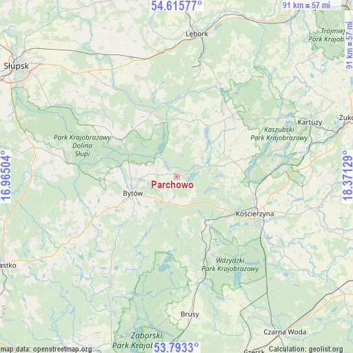
Parchowo GPS coordinates[2]
54° 12' 23.688" North, 17° 40' 5.376" East
| Map corner | latitude | longitude |
|---|---|---|
| Upper-left | 54.61577°, | 16.96504° |
| Center: | 54.20658°, | 17.66816° |
| Lower-right: | 53.7933°, | 18.37129° |
| Map W x H: | 91.5×91.4 km | = 56.9×56.8mi |
| max Lat: | 54.83135° ⇑3.6% North |
| Parchowo: | 54.20658° |
| min Lat: | ⇓96.4% South 49.21328° |
| min Long | Parchowo | max Long |
| 14.20249° | 17.66816° | 24.03723° |
| W 21.4%⇐ | ⇒78.6% E |
Elevation
Elevation of Parchowo is 188 m = 617 ft, and this is 3.4 m = 11 ft below average elevation for this country.
| Max E: |
974 m = 3196 ft | 44% |
| Avg. | 191.4 m = 628 ft | |
| Parchowo | 188 m = 617 ft | |
Min E: |
-3 m = -10 ft | 56% |
See also: Poland elevation on elevation.city.
Geographical zone
Parchowo is located in North temperate zone (between Tropic of Cancer and the Arctic Circle). Distance of this North polar circle is 1374 km =853.8 mi to North.| Distance of | km | miles | from Parchowo |
|---|---|---|---|
| North Pole | 3979.9 | 2473 | to North |
| Arctic Circle | 1374 | 853.8 | to North |
| Tropic Cancer | 3421.3 | 2125.9 | to South |
| Equator | 6027.2 | 3745.1 | to South |


Nearby cities:
15 places around Parchowo: (largest is in red/bold)
• Borzytuchom
19.5 km =12.1 mi,  267°
267°
• Bytów
12.1 km =7.5 mi,  250°
250°
• Cewice
25.8 km =16 mi,  9°
9°
• Czarna Dąbrówka
18 km =11.2 mi,  338°
338°
• Dziemiany
23.2 km =14.4 mi,  163°
163°
• Kalisz Pomorski
20 km =12.4 mi,  154°
154°
• Kołczygłowy
28.6 km =17.8 mi,  277°
277°
• Kościerzyna
22.4 km =13.9 mi,  114°
114°
• Lipusz
14.2 km =8.8 mi, 147°
• Sierakowice
21.3 km =13.2 mi,  43°
43°
• Studzienice
14 km =8.7 mi,  205°
205°
• Stężyca
18.7 km =11.6 mi,  90°
90°
• Sulęczyno
7.4 km =4.6 mi,  66°
66°
• Tuchomie
23.9 km =14.9 mi,  244°
244°
• Łupawa
28.8 km =17.9 mi,  325°
325°
Sources, notices
• [Note1] Compared only with cities in Poland existing in our database
• [Src1] Map data: © OpenStreetMap contributors (CC-BY-SA)
• [Src2] Other city data from geonames.org with taken over terms of usage.
• [Src3] Geographical zone / Annual Mean Temperature by Robert A. Rohde @ Wikipedia
