Zagnańsk geodata
Zagnańsk (Świętokrzyskie) is a seat of a third-order administrative division; located in Poland in Europe/Warsaw (GMT+2) time zone. With population of 1,726 people, there are 1659 cities with bigger population in this country. Compared to other cities in Poland, 55.7% of cities are located further ↑North; 67% of cities are located further ←West and 89.2% of cities have lower elevation than Zagnańsk. Note1


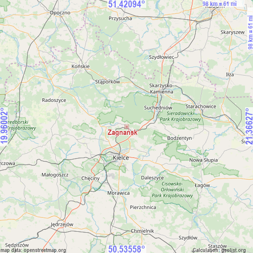
Zagnańsk GPS coordinates[2]
50° 58' 49.332" North, 20° 39' 47.304" East
| Map corner | latitude | longitude |
|---|---|---|
| Upper-left | 51.42094°, | 19.96002° |
| Center: | 50.98037°, | 20.66314° |
| Lower-right: | 50.53558°, | 21.36627° |
| Map W x H: | 98.4×98.4 km | = 61.1×61.1mi |
| max Lat: | 54.83135° ⇑55.7% North |
| Zagnańsk: | 50.98037° |
| min Lat: | ⇓44.3% South 49.21328° |
| min Long | Zagnańsk | max Long |
| 14.20249° | 20.66314° | 24.03723° |
| W 67%⇐ | ⇒33% E |
Elevation
Elevation of Zagnańsk is 319 m = 1047 ft, and this is 127.6 m = 419 ft above average elevation for this country.
| Max E: |
974 m = 3196 ft | 10.8% |
| Zagnańsk | 319 m 1047 ft | |
| Avg. | 191.4 m = 628 ft | |
Min E: |
-3 m = -10 ft | 89.2% |
See also: Poland elevation on elevation.city.
Geographical zone
Zagnańsk is located in North temperate zone (between Tropic of Cancer and the Arctic Circle). Distance of this North polar circle is 1732.7 km =1076.6 mi to North.| Distance of | km | miles | from Zagnańsk |
|---|---|---|---|
| North Pole | 4338.6 | 2695.9 | to North |
| Arctic Circle | 1732.7 | 1076.6 | to North |
| Tropic Cancer | 3062.6 | 1903 | to South |
| Equator | 5668.5 | 3522.2 | to South |


Nearby cities:
15 places around Zagnańsk: (largest is in red/bold)
• Bliżyn
15.7 km =9.8 mi,  25°
25°
• Domaszowice
11.8 km =7.3 mi,  173°
173°
• Gózd
7.2 km =4.5 mi,  86°
86°
• Kaniów
0.6 km =0.4 mi,  5°
5°
• Kielce
12.5 km =7.8 mi,  191°
191°
• Kostomłoty Drugie
9.1 km =5.7 mi,  229°
229°
• Kostomłoty Pierwsze
8 km =5 mi,  216°
216°
• Masłów
9.8 km =6.1 mi,  154°
154°
• Miedziana Góra
9.2 km =5.7 mi,  238°
238°
• Mniów
13 km =8.1 mi,  285°
285°
• Oblęgórek
12.9 km =8 mi,  256°
256°
• Strawczyn
17.5 km =10.9 mi, 255°
• Suchedniów
13.8 km =8.6 mi,  57°
57°
• Łączna
9.7 km =6 mi,  75°
75°
• Świerczów
15.1 km =9.4 mi,  351°
351°
Sources, notices
• [Note1] Compared only with cities in Poland existing in our database
• [Src1] Map data: © OpenStreetMap contributors (CC-BY-SA)
• [Src2] Other city data from geonames.org with taken over terms of usage.
• [Src3] Geographical zone / Annual Mean Temperature by Robert A. Rohde @ Wikipedia
