Wielgolas geodata
Wielgolas (Mazovia) is a populated place; located in Poland in Europe/Warsaw (GMT+2) time zone. With population of 791 people, there are 2875 cities with bigger population in this country. Compared to other cities in Poland, 66.2% of cities are located further ↓South; 81.4% of cities are located further ←West and 61.5% of cities have higher elevation than Wielgolas. Note1


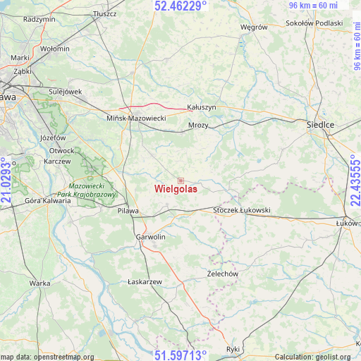
Wielgolas GPS coordinates[2]
52° 1' 54.48" North, 21° 43' 56.712" East
| Map corner | latitude | longitude |
|---|---|---|
| Upper-left | 52.46229°, | 21.0293° |
| Center: | 52.0318°, | 21.73242° |
| Lower-right: | 51.59713°, | 22.43555° |
| Map W x H: | 96.2×96.2 km | = 59.8×59.8mi |
| max Lat: | 54.83135° ⇑33.8% North |
| Wielgolas: | 52.0318° |
| min Lat: | ⇓66.2% South 49.21328° |
| min Long | Wielgolas | max Long |
| 14.20249° | 21.73242° | 24.03723° |
| W 81.4%⇐ | ⇒18.6% E |
Elevation
Elevation of Wielgolas is 143 m = 469 ft, and this is 48.4 m = 159 ft below average elevation for this country.
| Max E: |
974 m = 3196 ft | 61.5% |
| Avg. | 191.4 m = 628 ft | |
| Wielgolas | 143 m = 469 ft | |
Min E: |
-3 m = -10 ft | 38.5% |
See also: Poland elevation on elevation.city.
Geographical zone
Wielgolas is located in North temperate zone (between Tropic of Cancer and the Arctic Circle). Distance of this North polar circle is 1615.8 km =1004 mi to North.| Distance of | km | miles | from Wielgolas |
|---|---|---|---|
| North Pole | 4221.7 | 2623.2 | to North |
| Arctic Circle | 1615.8 | 1004 | to North |
| Tropic Cancer | 3179.5 | 1975.6 | to South |
| Equator | 5785.4 | 3594.9 | to South |


Nearby cities:
15 places around Wielgolas: (largest is in red/bold)
• Borowie
9.5 km =5.9 mi,  166°
166°
• Cegłów
12.9 km =8 mi,  1°
1°
• Garwolin
17 km =10.6 mi,  208°
208°
• Kołbiel
17.5 km =10.9 mi,  281°
281°
• Latowicz
5.2 km =3.2 mi,  96°
96°
• Miastków Kościelny
17.6 km =10.9 mi,  158°
158°
• Miętne
16.4 km =10.2 mi,  221°
221°
• Mrozy
15.7 km =9.8 mi,  17°
17°
• Parysów
7.2 km =4.5 mi, 209°
• Pilawa
16 km =9.9 mi,  239°
239°
• Pogorzel
13.5 km =8.4 mi,  312°
312°
• Siennica
10.2 km =6.3 mi, 310°
• Stoczek Łukowski
18.1 km =11.2 mi,  115°
115°
• Trąbki
13 km =8.1 mi, 224°
• Wodynie
15.3 km =9.5 mi,  86°
86°
Sources, notices
• [Note1] Compared only with cities in Poland existing in our database
• [Src1] Map data: © OpenStreetMap contributors (CC-BY-SA)
• [Src2] Other city data from geonames.org with taken over terms of usage.
• [Src3] Geographical zone / Annual Mean Temperature by Robert A. Rohde @ Wikipedia
