Miętne geodata
Miętne (Mazovia) is a populated place; located in Poland in Europe/Warsaw (GMT+2) time zone. With population of 2,000 people, there are 1469 cities with bigger population in this country. Compared to other cities in Poland, 64.2% of cities are located further ↓South; 79.8% of cities are located further ←West and 63.7% of cities have higher elevation than Miętne. Note1


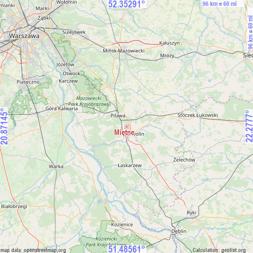
Miętne GPS coordinates[2]
51° 55' 16.86" North, 21° 34' 28.452" East
| Map corner | latitude | longitude |
|---|---|---|
| Upper-left | 52.35291°, | 20.87145° |
| Center: | 51.92135°, | 21.57457° |
| Lower-right: | 51.48561°, | 22.2777° |
| Map W x H: | 96.4×96.4 km | = 59.9×59.9mi |
| max Lat: | 54.83135° ⇑35.8% North |
| Miętne: | 51.92135° |
| min Lat: | ⇓64.2% South 49.21328° |
| min Long | Miętne | max Long |
| 14.20249° | 21.57457° | 24.03723° |
| W 79.8%⇐ | ⇒20.2% E |
Elevation
Elevation of Miętne is 137 m = 449 ft, and this is 54.4 m = 178 ft below average elevation for this country.
| Max E: |
974 m = 3196 ft | 63.7% |
| Avg. | 191.4 m = 628 ft | |
| Miętne | 137 m = 449 ft | |
Min E: |
-3 m = -10 ft | 36.3% |
See also: Poland elevation on elevation.city.
Geographical zone
Miętne is located in North temperate zone (between Tropic of Cancer and the Arctic Circle). Distance of this North polar circle is 1628.1 km =1011.7 mi to North.| Distance of | km | miles | from Miętne |
|---|---|---|---|
| North Pole | 4233.9 | 2630.8 | to North |
| Arctic Circle | 1628.1 | 1011.7 | to North |
| Tropic Cancer | 3167.2 | 1968 | to South |
| Equator | 5773.1 | 3587.2 | to South |


Nearby cities:
15 places around Miętne: (largest is in red/bold)
• Borowie
13.5 km =8.4 mi,  76°
76°
• Garwolin
3.8 km =2.4 mi,  133°
133°
• Górzno
12.4 km =7.7 mi, 131°
• Kołbiel
17.1 km =10.6 mi,  338°
338°
• Miastków Kościelny
17.7 km =11 mi,  103°
103°
• Osieck
11.8 km =7.3 mi,  295°
295°
• Parysów
9.4 km =5.8 mi,  50°
50°
• Pilawa
5.2 km =3.2 mi,  324°
324°
• Rębków
5.2 km =3.2 mi,  195°
195°
• Sulbiny Górne
6.6 km =4.1 mi,  143°
143°
• Trąbki
3.4 km =2.1 mi,  29°
29°
• Wielgolas
16.4 km =10.2 mi,  41°
41°
• Wilga
15.6 km =9.7 mi,  240°
240°
• Wola Rębkowska
2.4 km =1.5 mi,  207°
207°
• Łaskarzew
14.7 km =9.1 mi,  175°
175°
Sources, notices
• [Note1] Compared only with cities in Poland existing in our database
• [Src1] Map data: © OpenStreetMap contributors (CC-BY-SA)
• [Src2] Other city data from geonames.org with taken over terms of usage.
• [Src3] Geographical zone / Annual Mean Temperature by Robert A. Rohde @ Wikipedia
