Pilawa geodata
Pilawa (Mazovia) is a seat of a third-order administrative division; located in Poland in Europe/Warsaw (GMT+2) time zone. With population of 4,278 people, there are 767 cities with bigger population in this country. Compared to other cities in Poland, 64.9% of cities are located further ↓South; 79.4% of cities are located further ←West and 59.5% of cities have higher elevation than Pilawa. Note1


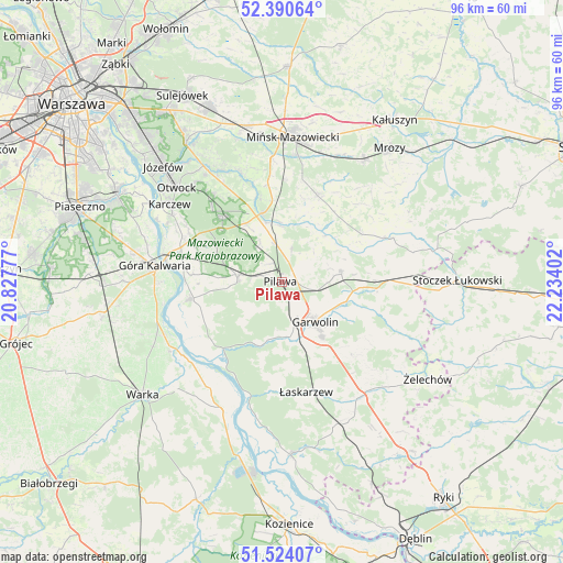
Pilawa GPS coordinates[2]
51° 57' 34.02" North, 21° 31' 51.204" East
| Map corner | latitude | longitude |
|---|---|---|
| Upper-left | 52.39064°, | 20.82777° |
| Center: | 51.95945°, | 21.53089° |
| Lower-right: | 51.52407°, | 22.23402° |
| Map W x H: | 96.4×96.4 km | = 59.9×59.9mi |
| max Lat: | 54.83135° ⇑35.1% North |
| Pilawa: | 51.95945° |
| min Lat: | ⇓64.9% South 49.21328° |
| min Long | Pilawa | max Long |
| 14.20249° | 21.53089° | 24.03723° |
| W 79.4%⇐ | ⇒20.6% E |
Elevation
Elevation of Pilawa is 148 m = 486 ft, and this is 43.4 m = 142 ft below average elevation for this country.
| Max E: |
974 m = 3196 ft | 59.5% |
| Avg. | 191.4 m = 628 ft | |
| Pilawa | 148 m = 486 ft | |
Min E: |
-3 m = -10 ft | 40.5% |
See also: Poland elevation on elevation.city.
Geographical zone
Pilawa is located in North temperate zone (between Tropic of Cancer and the Arctic Circle). Distance of this North polar circle is 1623.8 km =1009 mi to North.| Distance of | km | miles | from Pilawa |
|---|---|---|---|
| North Pole | 4229.7 | 2628.2 | to North |
| Arctic Circle | 1623.8 | 1009 | to North |
| Tropic Cancer | 3171.4 | 1970.6 | to South |
| Equator | 5777.3 | 3589.8 | to South |


Nearby cities:
15 places around Pilawa: (largest is in red/bold)
• Borowie
16.1 km =10 mi,  94°
94°
• Celestynów
14.8 km =9.2 mi,  319°
319°
• Garwolin
9 km =5.6 mi,  140°
140°
• Kołbiel
12.1 km =7.5 mi,  343°
343°
• Miętne
5.2 km =3.2 mi, 144°
• Osieck
7.7 km =4.8 mi,  275°
275°
• Parysów
10.4 km =6.5 mi,  79°
79°
• Rębków
9.4 km =5.8 mi,  170°
170°
• Siennica
15.9 km =9.9 mi,  22°
22°
• Sobienie Jeziory
15.9 km =9.9 mi,  259°
259°
• Sulbiny Górne
11.8 km =7.3 mi, 144°
• Trąbki
4.9 km =3 mi,  105°
105°
• Wielgolas
16 km =9.9 mi,  59°
59°
• Wilga
15.9 km =9.9 mi,  221°
221°
• Wola Rębkowska
6.7 km =4.2 mi,  163°
163°
Sources, notices
• [Note1] Compared only with cities in Poland existing in our database
• [Src1] Map data: © OpenStreetMap contributors (CC-BY-SA)
• [Src2] Other city data from geonames.org with taken over terms of usage.
• [Src3] Geographical zone / Annual Mean Temperature by Robert A. Rohde @ Wikipedia
