Uście Gorlickie geodata
Uście Gorlickie (Lesser Poland) is a populated place; located in Poland in Europe/Warsaw (GMT+2) time zone. With population of 1,172 people, there are 2237 cities with bigger population in this country. Compared to other cities in Poland, 97.9% of cities are located further ↑North; 74.9% of cities are located further ←West and 94.5% of cities have lower elevation than Uście Gorlickie. Note1
Administrative division(s):
- Level 1: Lesser Poland
- Level 2: Powiat gorlicki
- Level 3: Uście Gorlickie


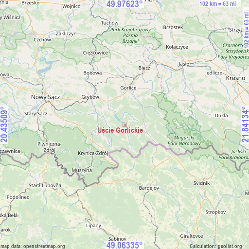
Uście Gorlickie GPS coordinates[2]
49° 31' 18.912" North, 21° 8' 17.556" East
| Map corner | latitude | longitude |
|---|---|---|
| Upper-left | 49.97623°, | 20.43509° |
| Center: | 49.52192°, | 21.13821° |
| Lower-right: | 49.06335°, | 21.84134° |
| Map W x H: | 101.5×101.5 km | = 63.1×63.1mi |
| max Lat: | 54.83135° ⇑97.9% North |
| Uście Gorlickie: | 49.52192° |
| min Lat: | ⇓2.1% South 49.21328° |
| min Long | Uście Gorlicki | max Long |
| 14.20249° | 21.13821° | 24.03723° |
| W 74.9%⇐ | ⇒25.1% E |
Elevation
Elevation of Uście Gorlickie is 404 m = 1325 ft, and this is 212.6 m = 698 ft above average elevation for this country.
| Max E: |
974 m = 3196 ft | 5.5% |
| Uście Gorlickie | 404 m 1325 ft | |
| Avg. | 191.4 m = 628 ft | |
Min E: |
-3 m = -10 ft | 94.5% |
See also: Poland elevation on elevation.city.
Geographical zone
Uście Gorlickie is located in North temperate zone (between Tropic of Cancer and the Arctic Circle). Distance of this North polar circle is 1894.9 km =1177.4 mi to North.| Distance of | km | miles | from Uście Gorlickie |
|---|---|---|---|
| North Pole | 4500.7 | 2796.6 | to North |
| Arctic Circle | 1894.9 | 1177.4 | to North |
| Tropic Cancer | 2900.4 | 1802.2 | to South |
| Equator | 5506.3 | 3421.5 | to South |


Nearby cities:
15 places around Uście Gorlickie: (largest is in red/bold)
• Bystra
16.1 km =10 mi,  346°
346°
• Gorlice
15 km =9.3 mi,  6°
6°
• Grybów
17.8 km =11.1 mi,  309°
309°
• Kamionka Wielka
23.3 km =14.5 mi,  282°
282°
• Kobylanka
17.4 km =10.8 mi,  20°
20°
• Korczyna
22.7 km =14.1 mi, 20°
• Krynica-Zdrój
17 km =10.6 mi,  229°
229°
• Kwiatonowice
22.2 km =13.8 mi,  4°
4°
• Lipinki
20.2 km =12.6 mi,  33°
33°
• Pielgrzymka
24.1 km =15 mi,  64°
64°
• Ropa
10.3 km =6.4 mi,  318°
318°
• Sękowa
11.9 km =7.4 mi, 21°
• Tylicz
16.3 km =10.1 mi,  210°
210°
• Łabowa
20.5 km =12.7 mi,  271°
271°
• Łużna
22.2 km =13.8 mi,  342°
342°
Sources, notices
• [Note1] Compared only with cities in Poland existing in our database
• [Src1] Map data: © OpenStreetMap contributors (CC-BY-SA)
• [Src2] Other city data from geonames.org with taken over terms of usage.
• [Src3] Geographical zone / Annual Mean Temperature by Robert A. Rohde @ Wikipedia
