Pielgrzymka geodata
Pielgrzymka (Subcarpathian) is a populated place; located in Poland in Europe/Warsaw (GMT+2) time zone. With population of 719 people, there are 3038 cities with bigger population in this country. Compared to other cities in Poland, 96.3% of cities are located further ↑North; 78.5% of cities are located further ←West and 87.3% of cities have lower elevation than Pielgrzymka. Note1
Administrative division(s):
- Level 1: Subcarpathian
- Level 2: Powiat jasielski
- Level 3: Osiek Jasielski


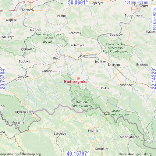
Pielgrzymka GPS coordinates[2]
49° 36' 56.376" North, 21° 26' 24.576" East
| Map corner | latitude | longitude |
|---|---|---|
| Upper-left | 50.0691°, | 20.73704° |
| Center: | 49.61566°, | 21.44016° |
| Lower-right: | 49.15797°, | 22.14329° |
| Map W x H: | 101.3×101.3 km | = 62.9×62.9mi |
| max Lat: | 54.83135° ⇑96.3% North |
| Pielgrzymka: | 49.61566° |
| min Lat: | ⇓3.7% South 49.21328° |
| min Long | Pielgrzymka | max Long |
| 14.20249° | 21.44016° | 24.03723° |
| W 78.5%⇐ | ⇒21.5% E |
Elevation
Elevation of Pielgrzymka is 304 m = 997 ft, and this is 112.6 m = 369 ft above average elevation for this country.
| Max E: |
974 m = 3196 ft | 12.7% |
| Pielgrzymka | 304 m 997 ft | |
| Avg. | 191.4 m = 628 ft | |
Min E: |
-3 m = -10 ft | 87.3% |
See also: Poland elevation on elevation.city.
Geographical zone
Pielgrzymka is located in North temperate zone (between Tropic of Cancer and the Arctic Circle). Distance of this North polar circle is 1884.4 km =1170.9 mi to North.| Distance of | km | miles | from Pielgrzymka |
|---|---|---|---|
| North Pole | 4490.3 | 2790.1 | to North |
| Arctic Circle | 1884.4 | 1170.9 | to North |
| Tropic Cancer | 2910.8 | 1808.7 | to South |
| Equator | 5516.7 | 3427.9 | to South |


Nearby cities:
15 places around Pielgrzymka: (largest is in red/bold)
• Biecz
18.5 km =11.5 mi,  316°
316°
• Chorkówka
17 km =10.6 mi,  78°
78°
• Dębowiec
7.7 km =4.8 mi,  11°
11°
• Jasło
14.6 km =9.1 mi, 9°
• Kobylanka
16.7 km =10.4 mi,  290°
290°
• Korczyna
17.4 km =10.8 mi,  308°
308°
• Krempna
12.4 km =7.7 mi,  159°
159°
• Lipinki
12.4 km =7.7 mi,  300°
300°
• Nowy Żmigród
6.2 km =3.9 mi,  102°
102°
• Osiek Jasielski
4.3 km =2.7 mi,  54°
54°
• Skołyszyn
16.6 km =10.3 mi,  333°
333°
• Sękowa
17.5 km =10.9 mi,  272°
272°
• Tarnowiec
16.2 km =10.1 mi,  37°
37°
• Trzcinica
14.3 km =8.9 mi,  353°
353°
• Zarzecze
7.5 km =4.7 mi,  23°
23°
Sources, notices
• [Note1] Compared only with cities in Poland existing in our database
• [Src1] Map data: © OpenStreetMap contributors (CC-BY-SA)
• [Src2] Other city data from geonames.org with taken over terms of usage.
• [Src3] Geographical zone / Annual Mean Temperature by Robert A. Rohde @ Wikipedia
