Turobin geodata
Turobin (Lublin) is a seat of a third-order administrative division; located in Poland in Europe/Warsaw (GMT+2) time zone. With population of 1,036 people, there are 2417 cities with bigger population in this country. Compared to other cities in Poland, 59.7% of cities are located further ↑North; 94.2% of cities are located further ←West and 65.3% of cities have lower elevation than Turobin. Note1


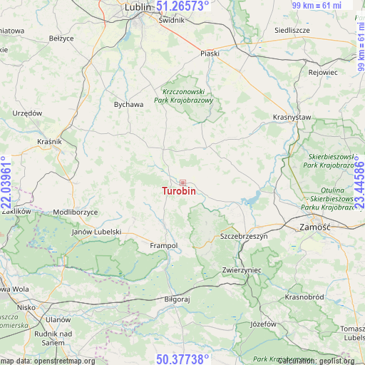
Turobin GPS coordinates[2]
50° 49' 25.212" North, 22° 44' 33.828" East
| Map corner | latitude | longitude |
|---|---|---|
| Upper-left | 51.26573°, | 22.03961° |
| Center: | 50.82367°, | 22.74273° |
| Lower-right: | 50.37738°, | 23.44586° |
| Map W x H: | 98.8×98.8 km | = 61.4×61.4mi |
| max Lat: | 54.83135° ⇑59.7% North |
| Turobin: | 50.82367° |
| min Lat: | ⇓40.3% South 49.21328° |
| min Long | Turobin | max Long |
| 14.20249° | 22.74273° | 24.03723° |
| W 94.2%⇐ | ⇒5.8% E |
Elevation
Elevation of Turobin is 215 m = 705 ft, and this is 23.6 m = 77 ft above average elevation for this country.
| Max E: |
974 m = 3196 ft | 34.7% |
| Turobin | 215 m 705 ft | |
| Avg. | 191.4 m = 628 ft | |
Min E: |
-3 m = -10 ft | 65.3% |
See also: Poland elevation on elevation.city.
Geographical zone
Turobin is located in North temperate zone (between Tropic of Cancer and the Arctic Circle). Distance of this North polar circle is 1750.1 km =1087.5 mi to North.| Distance of | km | miles | from Turobin |
|---|---|---|---|
| North Pole | 4356 | 2706.7 | to North |
| Arctic Circle | 1750.1 | 1087.5 | to North |
| Tropic Cancer | 3045.1 | 1892.1 | to South |
| Equator | 5651.1 | 3511.4 | to South |


Nearby cities:
15 places around Turobin: (largest is in red/bold)
• Batorz
17.8 km =11.1 mi,  279°
279°
• Chrzanów
11.3 km =7 mi,  239°
239°
• Dzwola
18.8 km =11.7 mi,  221°
221°
• Frampol
17.7 km =11 mi,  196°
196°
• Godziszów
19.1 km =11.9 mi, 244°
• Godziszów Drugi
19 km =11.8 mi, 240°
• Godziszów Trzeci
18.3 km =11.4 mi, 241°
• Goraj
12.5 km =7.8 mi,  205°
205°
• Radecznica
10.1 km =6.3 mi,  142°
142°
• Rudnik
17.3 km =10.7 mi,  68°
68°
• Sułów
16.1 km =10 mi,  111°
111°
• Wysokie
11.1 km =6.9 mi,  330°
330°
• Zakrzew
12.9 km =8 mi,  304°
304°
• Żabno
3.9 km =2.4 mi,  33°
33°
• Żółkiewka
11.6 km =7.2 mi, 33°
Sources, notices
• [Note1] Compared only with cities in Poland existing in our database
• [Src1] Map data: © OpenStreetMap contributors (CC-BY-SA)
• [Src2] Other city data from geonames.org with taken over terms of usage.
• [Src3] Geographical zone / Annual Mean Temperature by Robert A. Rohde @ Wikipedia
