Trzebownisko geodata
Trzebownisko (Subcarpathian) is a seat of a third-order administrative division; located in Poland in Europe/Warsaw (GMT+2) time zone. With population of 3,084 people, there are 1028 cities with bigger population in this country. Compared to other cities in Poland, 78.9% of cities are located further ↑North; 85.4% of cities are located further ←West and 59.2% of cities have lower elevation than Trzebownisko. Note1


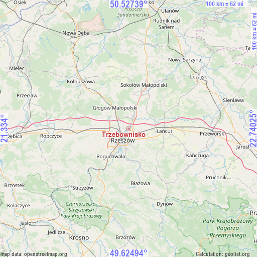
Trzebownisko GPS coordinates[2]
50° 4' 41.844" North, 22° 2' 13.632" East
| Map corner | latitude | longitude |
|---|---|---|
| Upper-left | 50.52739°, | 21.334° |
| Center: | 50.07829°, | 22.03712° |
| Lower-right: | 49.62494°, | 22.74025° |
| Map W x H: | 100.3×100.3 km | = 62.3×62.3mi |
| max Lat: | 54.83135° ⇑78.9% North |
| Trzebownisko: | 50.07829° |
| min Lat: | ⇓21.1% South 49.21328° |
| min Long | Trzebownisko | max Long |
| 14.20249° | 22.03712° | 24.03723° |
| W 85.4%⇐ | ⇒14.6% E |
Elevation
Elevation of Trzebownisko is 198 m = 650 ft, and this is 6.6 m = 22 ft above average elevation for this country.
| Max E: |
974 m = 3196 ft | 40.8% |
| Trzebownisko | 198 m 650 ft | |
| Avg. | 191.4 m = 628 ft | |
Min E: |
-3 m = -10 ft | 59.2% |
See also: Poland elevation on elevation.city.
Geographical zone
Trzebownisko is located in North temperate zone (between Tropic of Cancer and the Arctic Circle). Distance of this North polar circle is 1833 km =1139 mi to North.| Distance of | km | miles | from Trzebownisko |
|---|---|---|---|
| North Pole | 4438.9 | 2758.2 | to North |
| Arctic Circle | 1833 | 1139 | to North |
| Tropic Cancer | 2962.3 | 1840.7 | to South |
| Equator | 5568.2 | 3459.9 | to South |


Nearby cities:
15 places around Trzebownisko: (largest is in red/bold)
• Boguchwała
12.3 km =7.6 mi,  212°
212°
• Czarna
10.9 km =6.8 mi,  71°
71°
• Głogów Małopolski
9.7 km =6 mi,  326°
326°
• Kielanówka
9.7 km =6 mi,  233°
233°
• Kraczkowa
10.4 km =6.5 mi,  115°
115°
• Krasne
4.3 km =2.7 mi, 124°
• Krzemienica
10.4 km =6.5 mi,  99°
99°
• Przybyszówka
8.6 km =5.3 mi,  246°
246°
• Rudna Mała
5.9 km =3.7 mi,  292°
292°
• Rudna Wielka
6.5 km =4 mi,  279°
279°
• Rzeszów
4.9 km =3 mi, 213°
• Tyczyn
12.7 km =7.9 mi,  181°
181°
• Wysoka Głogowska
9.2 km =5.7 mi,  352°
352°
• Wólka Podleśna
6.9 km =4.3 mi,  50°
50°
• Świlcza
10 km =6.2 mi,  265°
265°
Sources, notices
• [Note1] Compared only with cities in Poland existing in our database
• [Src1] Map data: © OpenStreetMap contributors (CC-BY-SA)
• [Src2] Other city data from geonames.org with taken over terms of usage.
• [Src3] Geographical zone / Annual Mean Temperature by Robert A. Rohde @ Wikipedia
