Domanice geodata
Domanice (Mazovia) is a seat of a third-order administrative division; located in Poland in Europe/Warsaw (GMT+2) time zone. With population of 304 people, there are 3620 cities with bigger population in this country. Compared to other cities in Poland, 66.2% of cities are located further ↓South; 87.1% of cities are located further ←West and 51.3% of cities have higher elevation than Domanice. Note1


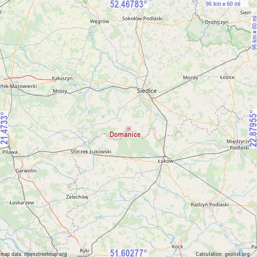
Domanice GPS coordinates[2]
52° 2' 14.604" North, 22° 10' 35.112" East
| Map corner | latitude | longitude |
|---|---|---|
| Upper-left | 52.46783°, | 21.4733° |
| Center: | 52.03739°, | 22.17642° |
| Lower-right: | 51.60277°, | 22.87955° |
| Map W x H: | 96.2×96.2 km | = 59.8×59.8mi |
| max Lat: | 54.83135° ⇑33.8% North |
| Domanice: | 52.03739° |
| min Lat: | ⇓66.2% South 49.21328° |
| min Long | Domanice | max Long |
| 14.20249° | 22.17642° | 24.03723° |
| W 87.1%⇐ | ⇒12.9% E |
Elevation
Elevation of Domanice is 169 m = 554 ft, and this is 22.4 m = 73 ft below average elevation for this country.
| Max E: |
974 m = 3196 ft | 51.3% |
| Avg. | 191.4 m = 628 ft | |
| Domanice | 169 m = 554 ft | |
Min E: |
-3 m = -10 ft | 48.7% |
See also: Poland elevation on elevation.city.
Geographical zone
Domanice is located in North temperate zone (between Tropic of Cancer and the Arctic Circle). Distance of this North polar circle is 1615.2 km =1003.6 mi to North.| Distance of | km | miles | from Domanice |
|---|---|---|---|
| North Pole | 4221 | 2622.8 | to North |
| Arctic Circle | 1615.2 | 1003.6 | to North |
| Tropic Cancer | 3180.1 | 1976 | to South |
| Equator | 5786 | 3595.3 | to South |


Nearby cities:
15 places around Domanice: (largest is in red/bold)
• Kotuń
17.1 km =10.6 mi,  334°
334°
• Krzywda
27 km =16.8 mi,  176°
176°
• Latowicz
25.2 km =15.7 mi,  267°
267°
• Mokobody
25.7 km =16 mi,  350°
350°
• Sarnów
21.8 km =13.5 mi,  156°
156°
• Siedlce
16.4 km =10.2 mi,  28°
28°
• Skórzec
8.4 km =5.2 mi,  338°
338°
• Stanin
18.7 km =11.6 mi,  174°
174°
• Stoczek Łukowski
16.4 km =10.2 mi,  238°
238°
• Suchożebry
25.2 km =15.7 mi,  11°
11°
• Trzebieszów
26.4 km =16.4 mi,  101°
101°
• Wiśniew
8.9 km =5.5 mi,  63°
63°
• Wodynie
15.1 km =9.4 mi, 271°
• Zbuczyn
18.8 km =11.7 mi,  71°
71°
• Łuków
18.4 km =11.4 mi,  130°
130°
Sources, notices
• [Note1] Compared only with cities in Poland existing in our database
• [Src1] Map data: © OpenStreetMap contributors (CC-BY-SA)
• [Src2] Other city data from geonames.org with taken over terms of usage.
• [Src3] Geographical zone / Annual Mean Temperature by Robert A. Rohde @ Wikipedia
