Starachowice geodata
Starachowice (Świętokrzyskie) is a seat of a second-order administrative division; located in Poland in Europe/Warsaw (GMT+2) time zone. With population of 53,739 people, there are 96 cities with bigger population in this country. Compared to other cities in Poland, 54.3% of cities are located further ↑North; 73.9% of cities are located further ←West and 63.3% of cities have lower elevation than Starachowice. Note1
Administrative division(s):
- Level 1: Świętokrzyskie
- Level 2: Powiat starachowicki
- Level 3: Starachowice


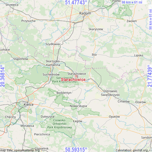
Starachowice GPS coordinates[2]
51° 2' 14.64" North, 21° 4' 16.536" East
| Map corner | latitude | longitude |
|---|---|---|
| Upper-left | 51.47743°, | 20.36814° |
| Center: | 51.0374°, | 21.07126° |
| Lower-right: | 50.59315°, | 21.77439° |
| Map W x H: | 98.3×98.3 km | = 61.1×61.1mi |
| max Lat: | 54.83135° ⇑54.3% North |
| Starachowice: | 51.0374° |
| min Lat: | ⇓45.7% South 49.21328° |
| min Long | Starachowice | max Long |
| 14.20249° | 21.07126° | 24.03723° |
| W 73.9%⇐ | ⇒26.1% E |
Elevation
Elevation of Starachowice is 210 m = 689 ft, and this is 18.6 m = 61 ft above average elevation for this country.
| Max E: |
974 m = 3196 ft | 36.7% |
| Starachowice | 210 m 689 ft | |
| Avg. | 191.4 m = 628 ft | |
Min E: |
-3 m = -10 ft | 63.3% |
See also: Starachowice elevation on elevation.city.
Geographical zone
Starachowice is located in North temperate zone (between Tropic of Cancer and the Arctic Circle). Distance of this North polar circle is 1726.3 km =1072.7 mi to North.| Distance of | km | miles | from Starachowice |
|---|---|---|---|
| North Pole | 4332.2 | 2691.9 | to North |
| Arctic Circle | 1726.3 | 1072.7 | to North |
| Tropic Cancer | 3068.9 | 1906.9 | to South |
| Equator | 5674.8 | 3526.2 | to South |


Nearby cities:
15 places around Starachowice: (largest is in red/bold)
• Adamów
5.8 km =3.6 mi,  110°
110°
• Bodzentyn
13.4 km =8.3 mi,  216°
216°
• Brody
10.6 km =6.6 mi,  97°
97°
• Godów
11.2 km =7 mi,  133°
133°
• Grzybowa Góra
13.1 km =8.1 mi,  324°
324°
• Mirzec
10.9 km =6.8 mi,  354°
354°
• Mirów Stary
16.6 km =10.3 mi, 353°
• Pawłów
9.1 km =5.7 mi,  157°
157°
• Rzepin Drugi
7.2 km =4.5 mi,  152°
152°
• Rzepin Pierwszy
6.1 km =3.8 mi,  176°
176°
• Skarżysko Kościelne
15.8 km =9.8 mi, 315°
• Skarżysko-Kamienna
16.3 km =10.1 mi,  301°
301°
• Sosnówka
15.1 km =9.4 mi, 175°
• Wielka Wieś
8.2 km =5.1 mi, 297°
• Wąchock
5.8 km =3.6 mi,  314°
314°
Sources, notices
• [Note1] Compared only with cities in Poland existing in our database
• [Src1] Map data: © OpenStreetMap contributors (CC-BY-SA)
• [Src2] Other city data from geonames.org with taken over terms of usage.
• [Src3] Geographical zone / Annual Mean Temperature by Robert A. Rohde @ Wikipedia
