Smęgorzów geodata
Smęgorzów (Lesser Poland) is a populated place; located in Poland in Europe/Warsaw (GMT+2) time zone. With population of 1,305 people, there are 2050 cities with bigger population in this country. Compared to other cities in Poland, 73.8% of cities are located further ↑North; 72.7% of cities are located further ←West and 51.6% of cities have higher elevation than Smęgorzów. Note1
Administrative division(s):
- Level 1: Lesser Poland
- Level 2: Powiat dąbrowski
- Level 3: Dąbrowa Tarnowska


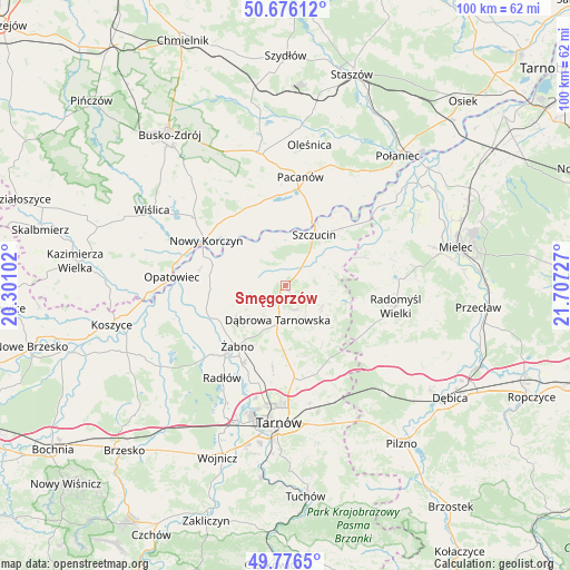
Smęgorzów GPS coordinates[2]
50° 13' 42.348" North, 21° 0' 14.904" East
| Map corner | latitude | longitude |
|---|---|---|
| Upper-left | 50.67612°, | 20.30102° |
| Center: | 50.22843°, | 21.00414° |
| Lower-right: | 49.7765°, | 21.70727° |
| Map W x H: | 100×100 km | = 62.1×62.1mi |
| max Lat: | 54.83135° ⇑73.8% North |
| Smęgorzów: | 50.22843° |
| min Lat: | ⇓26.2% South 49.21328° |
| min Long | Smęgorzów | max Long |
| 14.20249° | 21.00414° | 24.03723° |
| W 72.7%⇐ | ⇒27.3% E |
Elevation
Elevation of Smęgorzów is 168 m = 551 ft, and this is 23.4 m = 77 ft below average elevation for this country.
| Max E: |
974 m = 3196 ft | 51.6% |
| Avg. | 191.4 m = 628 ft | |
| Smęgorzów | 168 m = 551 ft | |
Min E: |
-3 m = -10 ft | 48.4% |
See also: Poland elevation on elevation.city.
Geographical zone
Smęgorzów is located in North temperate zone (between Tropic of Cancer and the Arctic Circle). Distance of this North polar circle is 1816.3 km =1128.6 mi to North.| Distance of | km | miles | from Smęgorzów |
|---|---|---|---|
| North Pole | 4422.2 | 2747.8 | to North |
| Arctic Circle | 1816.3 | 1128.6 | to North |
| Tropic Cancer | 2979 | 1851.1 | to South |
| Equator | 5584.9 | 3470.3 | to South |


Nearby cities:
15 places around Smęgorzów: (largest is in red/bold)
• Bolesław
8.9 km =5.5 mi,  304°
304°
• Dąbrowa Tarnowska
6.1 km =3.8 mi,  191°
191°
• Gorzyce
11.3 km =7 mi,  244°
244°
• Gruszów Wielki
4.5 km =2.8 mi,  154°
154°
• Mędrzechów
7.2 km =4.5 mi,  326°
326°
• Nieciecza
13.9 km =8.6 mi,  232°
232°
• Odporyszów
10.7 km =6.6 mi,  217°
217°
• Olesno
6.3 km =3.9 mi, 241°
• Radgoszcz
8.2 km =5.1 mi,  107°
107°
• Sieradza
11.7 km =7.3 mi,  207°
207°
• Smyków
12.8 km =8 mi,  137°
137°
• Swarzów
5 km =3.1 mi, 222°
• Szczucin
10.3 km =6.4 mi,  28°
28°
• Łukowa
15.2 km =9.4 mi, 187°
• Żabno
13.5 km =8.4 mi, 218°
Sources, notices
• [Note1] Compared only with cities in Poland existing in our database
• [Src1] Map data: © OpenStreetMap contributors (CC-BY-SA)
• [Src2] Other city data from geonames.org with taken over terms of usage.
• [Src3] Geographical zone / Annual Mean Temperature by Robert A. Rohde @ Wikipedia
