Rzeczków geodata
Rzeczków (Mazovia) is a populated place; located in Poland in Europe/Warsaw (GMT+2) time zone. With population of 562 people, there are 3374 cities with bigger population in this country. Compared to other cities in Poland, 52.4% of cities are located further ↓South; 73.7% of cities are located further ←West and 63.3% of cities have lower elevation than Rzeczków. Note1


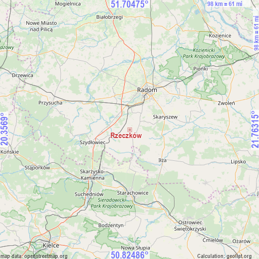
Rzeczków GPS coordinates[2]
51° 16' 0.876" North, 21° 3' 36.072" East
| Map corner | latitude | longitude |
|---|---|---|
| Upper-left | 51.70475°, | 20.3569° |
| Center: | 51.26691°, | 21.06002° |
| Lower-right: | 50.82486°, | 21.76315° |
| Map W x H: | 97.8×97.8 km | = 60.8×60.8mi |
| max Lat: | 54.83135° ⇑47.6% North |
| Rzeczków: | 51.26691° |
| min Lat: | ⇓52.4% South 49.21328° |
| min Long | Rzeczków | max Long |
| 14.20249° | 21.06002° | 24.03723° |
| W 73.7%⇐ | ⇒26.3% E |
Elevation
Elevation of Rzeczków is 210 m = 689 ft, and this is 18.6 m = 61 ft above average elevation for this country.
| Max E: |
974 m = 3196 ft | 36.7% |
| Rzeczków | 210 m 689 ft | |
| Avg. | 191.4 m = 628 ft | |
Min E: |
-3 m = -10 ft | 63.3% |
See also: Poland elevation on elevation.city.
Geographical zone
Rzeczków is located in North temperate zone (between Tropic of Cancer and the Arctic Circle). Distance of this North polar circle is 1700.8 km =1056.8 mi to North.| Distance of | km | miles | from Rzeczków |
|---|---|---|---|
| North Pole | 4306.7 | 2676.1 | to North |
| Arctic Circle | 1700.8 | 1056.8 | to North |
| Tropic Cancer | 3094.4 | 1922.8 | to South |
| Equator | 5700.3 | 3542 | to South |


Nearby cities:
15 places around Rzeczków: (largest is in red/bold)
• Jastrząb
8.1 km =5 mi,  254°
254°
• Kowala
6.5 km =4 mi,  5°
5°
• Ludwinów
9.4 km =5.8 mi,  15°
15°
• Mazowszany
9.6 km =6 mi,  33°
33°
• Mirów
8 km =5 mi,  193°
193°
• Mirów Stary
9.1 km =5.7 mi, 187°
• Orońsko
7.1 km =4.4 mi,  316°
316°
• Pakosław
11.6 km =7.2 mi,  136°
136°
• Rogów
8.4 km =5.2 mi,  205°
205°
• Skaryszew
14.2 km =8.8 mi,  69°
69°
• Szydłowiec
14.5 km =9 mi, 252°
• Sławno
13.8 km =8.6 mi,  345°
345°
• Trablice
10.6 km =6.6 mi, 26°
• Wierzbica
2.5 km =1.6 mi, 141°
• Wolanów
13.9 km =8.6 mi,  335°
335°
Sources, notices
• [Note1] Compared only with cities in Poland existing in our database
• [Src1] Map data: © OpenStreetMap contributors (CC-BY-SA)
• [Src2] Other city data from geonames.org with taken over terms of usage.
• [Src3] Geographical zone / Annual Mean Temperature by Robert A. Rohde @ Wikipedia
