Mirów geodata
Mirów (Mazovia) is a seat of a third-order administrative division; located in Poland in Europe/Warsaw (GMT+2) time zone. In our database, there are 3649 cities with bigger population. Compared to other cities in Poland, 50.9% of cities are located further ↓South; 73.1% of cities are located further ←West and 58.9% of cities have lower elevation than Mirów. Note1


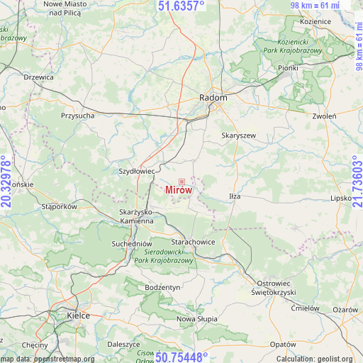
Mirów GPS coordinates[2]
51° 11' 49.92" North, 21° 1' 58.44" East
| Map corner | latitude | longitude |
|---|---|---|
| Upper-left | 51.6357°, | 20.32978° |
| Center: | 51.1972°, | 21.0329° |
| Lower-right: | 50.75448°, | 21.73603° |
| Map W x H: | 98×98 km | = 60.9×60.9mi |
| max Lat: | 54.83135° ⇑49.1% North |
| Mirów: | 51.1972° |
| min Lat: | ⇓50.9% South 49.21328° |
| min Long | Mirów | max Long |
| 14.20249° | 21.0329° | 24.03723° |
| W 73.1%⇐ | ⇒26.9% E |
Elevation
Elevation of Mirów is 197 m = 646 ft, and this is 5.6 m = 18 ft above average elevation for this country.
| Max E: |
974 m = 3196 ft | 41.1% |
| Mirów | 197 m 646 ft | |
| Avg. | 191.4 m = 628 ft | |
Min E: |
-3 m = -10 ft | 58.9% |
See also: Poland elevation on elevation.city.
Geographical zone
Mirów is located in North temperate zone (between Tropic of Cancer and the Arctic Circle). Distance of this North polar circle is 1708.6 km =1061.7 mi to North.| Distance of | km | miles | from Mirów |
|---|---|---|---|
| North Pole | 4314.5 | 2680.9 | to North |
| Arctic Circle | 1708.6 | 1061.7 | to North |
| Tropic Cancer | 3086.7 | 1918 | to South |
| Equator | 5692.6 | 3537.2 | to South |


Nearby cities:
15 places around Mirów: (largest is in red/bold)
• Grzybowa Góra
8.7 km =5.4 mi,  214°
214°
• Jastrząb
8.1 km =5 mi,  313°
313°
• Kowala
14.4 km =8.9 mi,  10°
10°
• Mirzec
7.2 km =4.5 mi,  166°
166°
• Mirów Stary
1.4 km =0.9 mi,  149°
149°
• Orońsko
13.2 km =8.2 mi,  347°
347°
• Pakosław
10 km =6.2 mi,  93°
93°
• Rogów
1.7 km =1.1 mi,  274°
274°
• Rzeczków
8 km =5 mi, 13°
• Skarżysko Kościelne
10.7 km =6.6 mi,  232°
232°
• Skarżysko-Kamienna
14.6 km =9.1 mi, 230°
• Szydłowiec
12.5 km =7.8 mi,  286°
286°
• Wielka Wieś
14.8 km =9.2 mi,  198°
198°
• Wierzbica
6.8 km =4.2 mi,  30°
30°
• Wąchock
13.8 km =8.6 mi,  185°
185°
Sources, notices
• [Note1] Compared only with cities in Poland existing in our database
• [Src1] Map data: © OpenStreetMap contributors (CC-BY-SA)
• [Src2] Other city data from geonames.org with taken over terms of usage.
• [Src3] Geographical zone / Annual Mean Temperature by Robert A. Rohde @ Wikipedia
