Rytro geodata
Rytro (Lesser Poland) is a populated place; located in Poland in Europe/Warsaw (GMT+2) time zone. With population of 3,700 people, there are 871 cities with bigger population in this country. Compared to other cities in Poland, 98.3% of cities are located further ↑North; 67.1% of cities are located further ←West and 93.3% of cities have lower elevation than Rytro. Note1


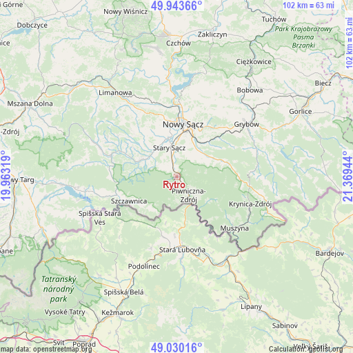
Rytro GPS coordinates[2]
49° 29' 20.544" North, 20° 39' 58.716" East
| Map corner | latitude | longitude |
|---|---|---|
| Upper-left | 49.94366°, | 19.96319° |
| Center: | 49.48904°, | 20.66631° |
| Lower-right: | 49.03016°, | 21.36944° |
| Map W x H: | 101.6×101.6 km | = 63.1×63.1mi |
| max Lat: | 54.83135° ⇑98.3% North |
| Rytro: | 49.48904° |
| min Lat: | ⇓1.7% South 49.21328° |
| min Long | Rytro | max Long |
| 14.20249° | 20.66631° | 24.03723° |
| W 67.1%⇐ | ⇒32.9% E |
Elevation
Elevation of Rytro is 377 m = 1237 ft, and this is 185.6 m = 609 ft above average elevation for this country.
| Max E: |
974 m = 3196 ft | 6.7% |
| Rytro | 377 m 1237 ft | |
| Avg. | 191.4 m = 628 ft | |
Min E: |
-3 m = -10 ft | 93.3% |
See also: Poland elevation on elevation.city.
Geographical zone
Rytro is located in North temperate zone (between Tropic of Cancer and the Arctic Circle). Distance of this North polar circle is 1898.5 km =1179.7 mi to North.| Distance of | km | miles | from Rytro |
|---|---|---|---|
| North Pole | 4504.4 | 2798.9 | to North |
| Arctic Circle | 1898.5 | 1179.7 | to North |
| Tropic Cancer | 2896.7 | 1799.9 | to South |
| Equator | 5502.7 | 3419.2 | to South |


Nearby cities:
15 places around Rytro: (largest is in red/bold)
• Chełmiec
15.7 km =9.8 mi,  359°
359°
• Jastrzębie
17.8 km =11.1 mi,  310°
310°
• Kamionka Wielka
14.4 km =8.9 mi,  52°
52°
• Krościenko nad Dunajcem
18.2 km =11.3 mi,  252°
252°
• Naszacowice
11.5 km =7.1 mi,  316°
316°
• Nawojowa
10.1 km =6.3 mi,  31°
31°
• Nowy Sącz
14.9 km =9.3 mi,  8°
8°
• Olszana
13.6 km =8.5 mi, 309°
• Olszanka
11.7 km =7.3 mi, 309°
• Piwniczna-Zdrój
6.4 km =4 mi,  147°
147°
• Podegrodzie
11.3 km =7 mi,  330°
330°
• Stary Sącz
8.6 km =5.3 mi,  344°
344°
• Szczawnica
15 km =9.3 mi,  241°
241°
• Łabowa
14.3 km =8.9 mi,  72°
72°
• Łącko
18.3 km =11.4 mi,  294°
294°
Sources, notices
• [Note1] Compared only with cities in Poland existing in our database
• [Src1] Map data: © OpenStreetMap contributors (CC-BY-SA)
• [Src2] Other city data from geonames.org with taken over terms of usage.
• [Src3] Geographical zone / Annual Mean Temperature by Robert A. Rohde @ Wikipedia
