Olszanka geodata
Olszanka (Lesser Poland) is a populated place; located in Poland in Europe/Warsaw (GMT+2) time zone. With population of 571 people, there are 3356 cities with bigger population in this country. Compared to other cities in Poland, 97.5% of cities are located further ↑North; 65.5% of cities are located further ←West and 91.6% of cities have lower elevation than Olszanka. Note1


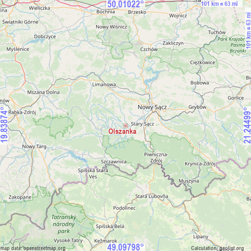
Olszanka GPS coordinates[2]
49° 33' 22.428" North, 20° 32' 30.696" East
| Map corner | latitude | longitude |
|---|---|---|
| Upper-left | 50.01022°, | 19.83874° |
| Center: | 49.55623°, | 20.54186° |
| Lower-right: | 49.09798°, | 21.24499° |
| Map W x H: | 101.4×101.4 km | = 63×63mi |
| max Lat: | 54.83135° ⇑97.5% North |
| Olszanka: | 49.55623° |
| min Lat: | ⇓2.5% South 49.21328° |
| min Long | Olszanka | max Long |
| 14.20249° | 20.54186° | 24.03723° |
| W 65.5%⇐ | ⇒34.5% E |
Elevation
Elevation of Olszanka is 351 m = 1152 ft, and this is 159.6 m = 524 ft above average elevation for this country.
| Max E: |
974 m = 3196 ft | 8.4% |
| Olszanka | 351 m 1152 ft | |
| Avg. | 191.4 m = 628 ft | |
Min E: |
-3 m = -10 ft | 91.6% |
See also: Poland elevation on elevation.city.
Geographical zone
Olszanka is located in North temperate zone (between Tropic of Cancer and the Arctic Circle). Distance of this North polar circle is 1891 km =1175 mi to North.| Distance of | km | miles | from Olszanka |
|---|---|---|---|
| North Pole | 4496.9 | 2794.2 | to North |
| Arctic Circle | 1891 | 1175 | to North |
| Tropic Cancer | 2904.2 | 1804.6 | to South |
| Equator | 5510.1 | 3423.8 | to South |


Nearby cities:
15 places around Olszanka: (largest is in red/bold)
• Chełmiec
12.1 km =7.5 mi,  46°
46°
• Jastrzębie
6.1 km =3.8 mi,  311°
311°
• Kamienica
14.4 km =8.9 mi,  278°
278°
• Naszacowice
1.3 km =0.8 mi, 49°
• Nawojowa
14.3 km =8.9 mi,  85°
85°
• Nowy Sącz
13.4 km =8.3 mi,  56°
56°
• Ochotnica Dolna
14.7 km =9.1 mi,  257°
257°
• Olszana
1.9 km =1.2 mi, 310°
• Podegrodzie
4.1 km =2.5 mi, 55°
• Rytro
11.7 km =7.3 mi,  129°
129°
• Stary Sącz
6.8 km =4.2 mi,  83°
83°
• Wysokie
10.9 km =6.8 mi,  0°
0°
• Zagorzyn
10 km =6.2 mi, 283°
• Łukowica
7.4 km =4.6 mi,  325°
325°
• Łącko
7.6 km =4.7 mi,  271°
271°
Sources, notices
• [Note1] Compared only with cities in Poland existing in our database
• [Src1] Map data: © OpenStreetMap contributors (CC-BY-SA)
• [Src2] Other city data from geonames.org with taken over terms of usage.
• [Src3] Geographical zone / Annual Mean Temperature by Robert A. Rohde @ Wikipedia
