Radomyśl Wielki geodata
Radomyśl Wielki (Subcarpathian) is a populated place; located in Poland in Europe/Warsaw (GMT+2) time zone. With population of 2,992 people, there are 1055 cities with bigger population in this country. Compared to other cities in Poland, 74.6% of cities are located further ↑North; 76.7% of cities are located further ←West and 58.9% of cities have lower elevation than Radomyśl Wielki. Note1
Administrative division(s):
- Level 1: Subcarpathian
- Level 2: Powiat mielecki
- Level 3: Radomyśl Wielki


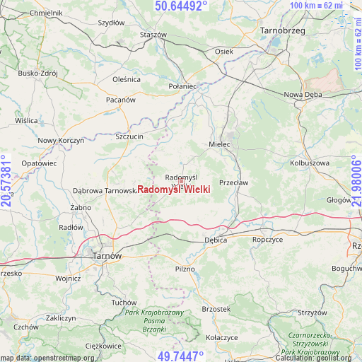
Radomyśl Wielki GPS coordinates[2]
50° 11' 48.948" North, 21° 16' 36.948" East
| Map corner | latitude | longitude |
|---|---|---|
| Upper-left | 50.64492°, | 20.57381° |
| Center: | 50.19693°, | 21.27693° |
| Lower-right: | 49.7447°, | 21.98006° |
| Map W x H: | 100.1×100.1 km | = 62.2×62.2mi |
| max Lat: | 54.83135° ⇑74.6% North |
| Radomyśl Wielki: | 50.19693° |
| min Lat: | ⇓25.4% South 49.21328° |
| min Long | Radomyśl Wielk | max Long |
| 14.20249° | 21.27693° | 24.03723° |
| W 76.7%⇐ | ⇒23.3% E |
Elevation
Elevation of Radomyśl Wielki is 197 m = 646 ft, and this is 5.6 m = 18 ft above average elevation for this country.
| Max E: |
974 m = 3196 ft | 41.1% |
| Radomyśl Wielki | 197 m 646 ft | |
| Avg. | 191.4 m = 628 ft | |
Min E: |
-3 m = -10 ft | 58.9% |
See also: Poland elevation on elevation.city.
Geographical zone
Radomyśl Wielki is located in North temperate zone (between Tropic of Cancer and the Arctic Circle). Distance of this North polar circle is 1819.8 km =1130.8 mi to North.| Distance of | km | miles | from Radomyśl Wielki |
|---|---|---|---|
| North Pole | 4425.7 | 2750 | to North |
| Arctic Circle | 1819.8 | 1130.8 | to North |
| Tropic Cancer | 2975.5 | 1848.9 | to South |
| Equator | 5581.4 | 3468.1 | to South |


Nearby cities:
15 places around Radomyśl Wielki: (largest is in red/bold)
• Brzeźnica
18 km =11.2 mi,  126°
126°
• Błonie
14.9 km =9.3 mi,  82°
82°
• Czarna
14.5 km =9 mi,  185°
185°
• Czermin
16.3 km =10.1 mi,  14°
14°
• Dębica
18.8 km =11.7 mi,  149°
149°
• Gruszów Wielki
17.5 km =10.9 mi,  268°
268°
• Mielec
14.5 km =9 mi,  46°
46°
• Przecław
14.5 km =9 mi,  91°
91°
• Radgoszcz
11.7 km =7.3 mi, 274°
• Smyków
12.2 km =7.6 mi,  241°
241°
• Szczucin
19.1 km =11.9 mi,  311°
311°
• Słupiec
15.7 km =9.8 mi,  337°
337°
• Trzciana
13 km =8.1 mi,  19°
19°
• Wadowice Górne
7.6 km =4.7 mi, 13°
• Żyraków
15 km =9.3 mi, 145°
Sources, notices
• [Note1] Compared only with cities in Poland existing in our database
• [Src1] Map data: © OpenStreetMap contributors (CC-BY-SA)
• [Src2] Other city data from geonames.org with taken over terms of usage.
• [Src3] Geographical zone / Annual Mean Temperature by Robert A. Rohde @ Wikipedia
