Przytyk geodata
Przytyk (Mazovia) is a seat of a third-order administrative division; located in Poland in Europe/Warsaw (GMT+2) time zone. With population of 990 people, there are 2509 cities with bigger population in this country. Compared to other cities in Poland, 55.7% of cities are located further ↓South; 70.9% of cities are located further ←West and 60.3% of cities have higher elevation than Przytyk. Note1


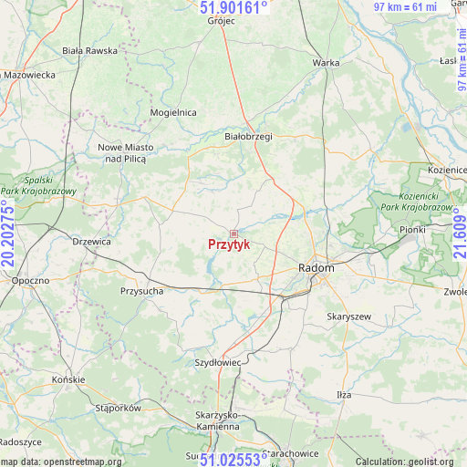
Przytyk GPS coordinates[2]
51° 27' 56.412" North, 20° 54' 21.132" East
| Map corner | latitude | longitude |
|---|---|---|
| Upper-left | 51.90161°, | 20.20275° |
| Center: | 51.46567°, | 20.90587° |
| Lower-right: | 51.02553°, | 21.609° |
| Map W x H: | 97.4×97.4 km | = 60.5×60.5mi |
| max Lat: | 54.83135° ⇑44.3% North |
| Przytyk: | 51.46567° |
| min Lat: | ⇓55.7% South 49.21328° |
| min Long | Przytyk | max Long |
| 14.20249° | 20.90587° | 24.03723° |
| W 70.9%⇐ | ⇒29.1% E |
Elevation
Elevation of Przytyk is 146 m = 479 ft, and this is 45.4 m = 149 ft below average elevation for this country.
| Max E: |
974 m = 3196 ft | 60.3% |
| Avg. | 191.4 m = 628 ft | |
| Przytyk | 146 m = 479 ft | |
Min E: |
-3 m = -10 ft | 39.7% |
See also: Poland elevation on elevation.city.
Geographical zone
Przytyk is located in North temperate zone (between Tropic of Cancer and the Arctic Circle). Distance of this North polar circle is 1678.7 km =1043.1 mi to North.| Distance of | km | miles | from Przytyk |
|---|---|---|---|
| North Pole | 4284.6 | 2662.3 | to North |
| Arctic Circle | 1678.7 | 1043.1 | to North |
| Tropic Cancer | 3116.5 | 1936.5 | to South |
| Equator | 5722.4 | 3555.7 | to South |


Nearby cities:
15 places around Przytyk: (largest is in red/bold)
• Jedlińsk
15.5 km =9.6 mi,  69°
69°
• Kowala
19.3 km =12 mi,  143°
143°
• Ludwinów
18.5 km =11.5 mi,  134°
134°
• Orońsko
17.9 km =11.1 mi,  160°
160°
• Potworów
13.6 km =8.5 mi,  290°
290°
• Radom
18.1 km =11.2 mi,  112°
112°
• Radzanów
10.7 km =6.6 mi,  344°
344°
• Stara Błotnica
10.2 km =6.3 mi,  27°
27°
• Sucha
17.4 km =10.8 mi,  9°
9°
• Sławno
11.4 km =7.1 mi, 139°
• Trablice
19.9 km =12.4 mi, 129°
• Wieniawa
13.9 km =8.6 mi,  213°
213°
• Wolanów
10.7 km =6.6 mi,  152°
152°
• Wyśmierzyce
18.8 km =11.7 mi, 340°
• Zakrzew
7.1 km =4.4 mi, 112°
Sources, notices
• [Note1] Compared only with cities in Poland existing in our database
• [Src1] Map data: © OpenStreetMap contributors (CC-BY-SA)
• [Src2] Other city data from geonames.org with taken over terms of usage.
• [Src3] Geographical zone / Annual Mean Temperature by Robert A. Rohde @ Wikipedia
