Wieniawa geodata
Wieniawa (Mazovia) is a seat of a third-order administrative division; located in Poland in Europe/Warsaw (GMT+2) time zone. With population of 687 people, there are 3095 cities with bigger population in this country. Compared to other cities in Poland, 54.3% of cities are located further ↓South; 68.9% of cities are located further ←West and 50.8% of cities have higher elevation than Wieniawa. Note1


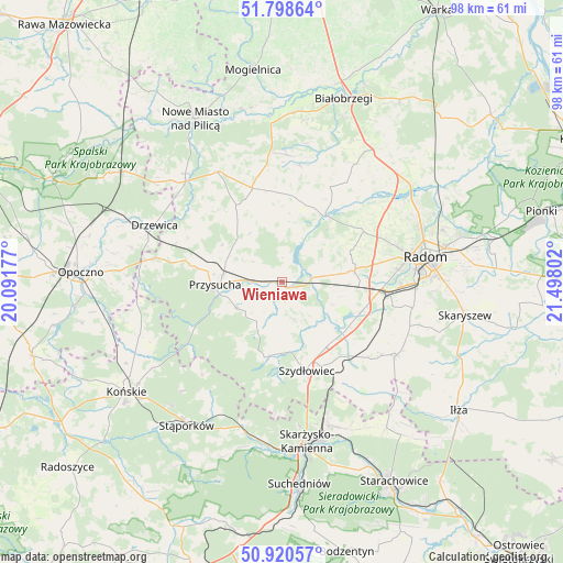
Wieniawa GPS coordinates[2]
51° 21' 42.156" North, 20° 47' 41.604" East
| Map corner | latitude | longitude |
|---|---|---|
| Upper-left | 51.79864°, | 20.09177° |
| Center: | 51.36171°, | 20.79489° |
| Lower-right: | 50.92057°, | 21.49802° |
| Map W x H: | 97.6×97.6 km | = 60.6×60.6mi |
| max Lat: | 54.83135° ⇑45.7% North |
| Wieniawa: | 51.36171° |
| min Lat: | ⇓54.3% South 49.21328° |
| min Long | Wieniawa | max Long |
| 14.20249° | 20.79489° | 24.03723° |
| W 68.9%⇐ | ⇒31.1% E |
Elevation
Elevation of Wieniawa is 170 m = 558 ft, and this is 21.4 m = 70 ft below average elevation for this country.
| Max E: |
974 m = 3196 ft | 50.8% |
| Avg. | 191.4 m = 628 ft | |
| Wieniawa | 170 m = 558 ft | |
Min E: |
-3 m = -10 ft | 49.2% |
See also: Poland elevation on elevation.city.
Geographical zone
Wieniawa is located in North temperate zone (between Tropic of Cancer and the Arctic Circle). Distance of this North polar circle is 1690.3 km =1050.3 mi to North.| Distance of | km | miles | from Wieniawa |
|---|---|---|---|
| North Pole | 4296.2 | 2669.5 | to North |
| Arctic Circle | 1690.3 | 1050.3 | to North |
| Tropic Cancer | 3105 | 1929.4 | to South |
| Equator | 5710.9 | 3548.6 | to South |


Nearby cities:
15 places around Wieniawa: (largest is in red/bold)
• Borkowice
9 km =5.6 mi,  239°
239°
• Chlewiska
13.2 km =8.2 mi,  187°
187°
• Jastrząb
16.6 km =10.3 mi,  140°
140°
• Kowala
19.5 km =12.1 mi,  102°
102°
• Ludwinów
20.9 km =13 mi,  94°
94°
• Orońsko
14.6 km =9.1 mi,  111°
111°
• Pawłów
12.1 km =7.5 mi,  173°
173°
• Potworów
17.1 km =10.6 mi,  342°
342°
• Przysucha
11.5 km =7.1 mi,  268°
268°
• Przytyk
13.9 km =8.6 mi,  33°
33°
• Rusinów
16.7 km =10.4 mi,  300°
300°
• Szydłowiec
15.5 km =9.6 mi,  162°
162°
• Sławno
15.3 km =9.5 mi,  79°
79°
• Wolanów
12.8 km =8 mi, 80°
• Zakrzew
16.8 km =10.4 mi,  58°
58°
Sources, notices
• [Note1] Compared only with cities in Poland existing in our database
• [Src1] Map data: © OpenStreetMap contributors (CC-BY-SA)
• [Src2] Other city data from geonames.org with taken over terms of usage.
• [Src3] Geographical zone / Annual Mean Temperature by Robert A. Rohde @ Wikipedia
