Sobienie Jeziory geodata
Sobienie Jeziory (Mazovia) is a seat of a third-order administrative division; located in Poland in Europe/Warsaw (GMT+2) time zone. With population of 700 people, there are 3061 cities with bigger population in this country. Compared to other cities in Poland, 64.4% of cities are located further ↓South; 77% of cities are located further ←West and 81.2% of cities have higher elevation than Sobienie Jeziory. Note1


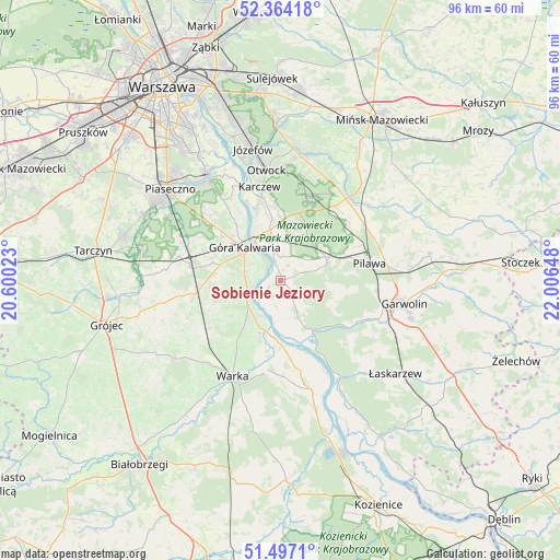
Sobienie Jeziory GPS coordinates[2]
51° 55' 57.828" North, 21° 18' 12.06" East
| Map corner | latitude | longitude |
|---|---|---|
| Upper-left | 52.36418°, | 20.60023° |
| Center: | 51.93273°, | 21.30335° |
| Lower-right: | 51.4971°, | 22.00648° |
| Map W x H: | 96.4×96.4 km | = 59.9×59.9mi |
| max Lat: | 54.83135° ⇑35.6% North |
| Sobienie Jeziory: | 51.93273° |
| min Lat: | ⇓64.4% South 49.21328° |
| min Long | Sobienie Jezior | max Long |
| 14.20249° | 21.30335° | 24.03723° |
| W 77%⇐ | ⇒23% E |
Elevation
Elevation of Sobienie Jeziory is 97 m = 318 ft, and this is 94.4 m = 310 ft below average elevation for this country.
| Max E: |
974 m = 3196 ft | 81.2% |
| Avg. | 191.4 m = 628 ft | |
| Sobienie Jeziory | 97 m = 318 ft | |
Min E: |
-3 m = -10 ft | 18.8% |
See also: Poland elevation on elevation.city.
Geographical zone
Sobienie Jeziory is located in North temperate zone (between Tropic of Cancer and the Arctic Circle). Distance of this North polar circle is 1626.8 km =1010.8 mi to North.| Distance of | km | miles | from Sobienie Jeziory |
|---|---|---|---|
| North Pole | 4232.7 | 2630.1 | to North |
| Arctic Circle | 1626.8 | 1010.8 | to North |
| Tropic Cancer | 3168.5 | 1968.8 | to South |
| Equator | 5774.4 | 3588 | to South |


Nearby cities:
15 places around Sobienie Jeziory: (largest is in red/bold)
• Baniocha
14.6 km =9.1 mi,  309°
309°
• Celestynów
15.5 km =9.6 mi,  22°
22°
• Chynów
15.5 km =9.6 mi,  258°
258°
• Czersk
5.7 km =3.5 mi,  300°
300°
• Góra Kalwaria
7.8 km =4.8 mi, 308°
• Karczew
16.4 km =10.2 mi,  347°
347°
• Kołbiel
19 km =11.8 mi,  39°
39°
• Miętne
18.6 km =11.6 mi,  93°
93°
• Osieck
8.8 km =5.5 mi,  64°
64°
• Pilawa
15.9 km =9.9 mi,  79°
79°
• Rębków
18.3 km =11.4 mi,  110°
110°
• Sułkowice
14.7 km =9.1 mi,  265°
265°
• Warka
18.2 km =11.3 mi,  205°
205°
• Wilga
10.3 km =6.4 mi,  150°
150°
• Wola Rębkowska
17.8 km =11.1 mi,  101°
101°
Sources, notices
• [Note1] Compared only with cities in Poland existing in our database
• [Src1] Map data: © OpenStreetMap contributors (CC-BY-SA)
• [Src2] Other city data from geonames.org with taken over terms of usage.
• [Src3] Geographical zone / Annual Mean Temperature by Robert A. Rohde @ Wikipedia
