Nowa Dęba geodata
Nowa Dęba (Subcarpathian) is a seat of a third-order administrative division; located in Poland in Europe/Warsaw (GMT+2) time zone. With population of 11,489 people, there are 406 cities with bigger population in this country. Compared to other cities in Poland, 68.8% of cities are located further ↑North; 81.7% of cities are located further ←West and 53.7% of cities have higher elevation than Nowa Dęba. Note1


Nowa Dęba GPS coordinates[2]
50° 25' 47.064" North, 21° 45' 2.808" East
| Map corner | latitude | longitude |
|---|---|---|
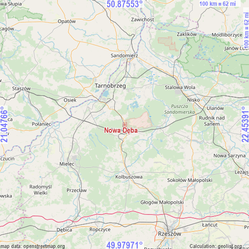
| Upper-left | 50.87553°, | 21.04766° |
| Center: | 50.42974°, | 21.75078° |
| Lower-right: | 49.97971°, | 22.45391° |
| Map W x H: | 99.6×99.6 km | = 61.9×61.9mi |
| max Lat: | 54.83135° ⇑68.8% North |
| Nowa Dęba: | 50.42974° |
| min Lat: | ⇓31.2% South 49.21328° |
| min Long | Nowa Dęba | max Long |
| 14.20249° | 21.75078° | 24.03723° |
| W 81.7%⇐ | ⇒18.3% E |
Elevation
Elevation of Nowa Dęba is 162 m = 531 ft, and this is 29.4 m = 96 ft below average elevation for this country.
| Max E: |
974 m = 3196 ft | 53.7% |
| Avg. | 191.4 m = 628 ft | |
| Nowa Dęba | 162 m = 531 ft | |
Min E: |
-3 m = -10 ft | 46.3% |
See also: Poland elevation on elevation.city.
Geographical zone
Nowa Dęba is located in North temperate zone (between Tropic of Cancer and the Arctic Circle). Distance of this North polar circle is 1793.9 km =1114.7 mi to North.| Distance of | km | miles | from Nowa Dęba |
|---|---|---|---|
| North Pole | 4399.8 | 2733.9 | to North |
| Arctic Circle | 1793.9 | 1114.7 | to North |
| Tropic Cancer | 3001.3 | 1864.9 | to South |
| Equator | 5607.3 | 3484.2 | to South |


Nearby cities:
15 places around Nowa Dęba: (largest is in red/bold)
• Baranów Sandomierski
16.7 km =10.4 mi,  297°
297°
• Bojanów
14.2 km =8.8 mi,  91°
91°
• Cmolas
15 km =9.3 mi,  181°
181°
• Dzikowiec
18.6 km =11.6 mi,  159°
159°
• Grębów
17.4 km =10.8 mi,  30°
30°
• Gwoździec
18 km =11.2 mi,  109°
109°
• Lipnica
18.4 km =11.4 mi,  148°
148°
• Majdan Królewski
5.6 km =3.5 mi, 183°
• Mechowiec
16.5 km =10.3 mi, 164°
• Ostrowy Baranowskie
12.2 km =7.6 mi,  212°
212°
• Ostrowy Tuszowskie
14.3 km =8.9 mi, 209°
• Padew Narodowa
17.8 km =11.1 mi,  273°
273°
• Przyłęk
19.9 km =12.4 mi, 210°
• Tarnobrzeg
16.7 km =10.4 mi,  342°
342°
• Świniary Stare
19.6 km =12.2 mi,  307°
307°
Sources, notices
• [Note1] Compared only with cities in Poland existing in our database
• [Src1] Map data: © OpenStreetMap contributors (CC-BY-SA)
• [Src2] Other city data from geonames.org with taken over terms of usage.
• [Src3] Geographical zone / Annual Mean Temperature by Robert A. Rohde @ Wikipedia
