Niebylec geodata
Niebylec (Subcarpathian) is a seat of a third-order administrative division; located in Poland in Europe/Warsaw (GMT+2) time zone. With population of 594 people, there are 3298 cities with bigger population in this country. Compared to other cities in Poland, 89.6% of cities are located further ↑North; 83.6% of cities are located further ←West and 79.8% of cities have lower elevation than Niebylec. Note1


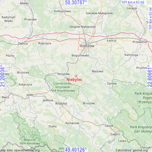
Niebylec GPS coordinates[2]
49° 51' 24.084" North, 21° 54' 12.528" East
| Map corner | latitude | longitude |
|---|---|---|
| Upper-left | 50.30787°, | 21.20036° |
| Center: | 49.85669°, | 21.90348° |
| Lower-right: | 49.40126°, | 22.60661° |
| Map W x H: | 100.8×100.8 km | = 62.6×62.6mi |
| max Lat: | 54.83135° ⇑89.6% North |
| Niebylec: | 49.85669° |
| min Lat: | ⇓10.4% South 49.21328° |
| min Long | Niebylec | max Long |
| 14.20249° | 21.90348° | 24.03723° |
| W 83.6%⇐ | ⇒16.4% E |
Elevation
Elevation of Niebylec is 265 m = 869 ft, and this is 73.6 m = 241 ft above average elevation for this country.
| Max E: |
974 m = 3196 ft | 20.2% |
| Niebylec | 265 m 869 ft | |
| Avg. | 191.4 m = 628 ft | |
Min E: |
-3 m = -10 ft | 79.8% |
See also: Poland elevation on elevation.city.
Geographical zone
Niebylec is located in North temperate zone (between Tropic of Cancer and the Arctic Circle). Distance of this North polar circle is 1857.6 km =1154.3 mi to North.| Distance of | km | miles | from Niebylec |
|---|---|---|---|
| North Pole | 4463.5 | 2773.5 | to North |
| Arctic Circle | 1857.6 | 1154.3 | to North |
| Tropic Cancer | 2937.6 | 1825.3 | to South |
| Equator | 5543.5 | 3444.6 | to South |


Nearby cities:
15 places around Niebylec: (largest is in red/bold)
• Babica
9 km =5.6 mi,  344°
344°
• Białka
9.6 km =6 mi,  80°
80°
• Czudec
10.8 km =6.7 mi, 335°
• Domaradz
8.3 km =5.2 mi,  158°
158°
• Gwoźnica Górna
7.5 km =4.7 mi,  115°
115°
• Jawornik
1.3 km =0.8 mi,  210°
210°
• Konieczkowa
2.4 km =1.5 mi,  132°
132°
• Krasna
9.7 km =6 mi,  201°
201°
• Lecka
8.3 km =5.2 mi,  72°
72°
• Lubenia
8.4 km =5.2 mi,  11°
11°
• Połomia
5.4 km =3.4 mi,  351°
351°
• Siedliska
11.3 km =7 mi,  16°
16°
• Straszydle
7.4 km =4.6 mi,  48°
48°
• Strzyżów
8 km =5 mi,  281°
281°
• Zarzecze
10.6 km =6.6 mi, 5°
Sources, notices
• [Note1] Compared only with cities in Poland existing in our database
• [Src1] Map data: © OpenStreetMap contributors (CC-BY-SA)
• [Src2] Other city data from geonames.org with taken over terms of usage.
• [Src3] Geographical zone / Annual Mean Temperature by Robert A. Rohde @ Wikipedia
