Lublin geodata
Lublin is a seat of a first-order administrative division; located in Poland in Europe/Warsaw (GMT+2) time zone. With population of 360,044 people, there are 8 cities with bigger population in this country. Compared to other cities in Poland, 52.2% of cities are located further ↓South; 92.4% of cities are located further ←West and 54.4% of cities have lower elevation than Lublin. Note1


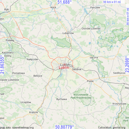
Lublin GPS coordinates[2]
51° 15' 0" North, 22° 34' 0.012" East
| Map corner | latitude | longitude |
|---|---|---|
| Upper-left | 51.688°, | 21.86355° |
| Center: | 51.25°, | 22.56667° |
| Lower-right: | 50.80779°, | 23.2698° |
| Map W x H: | 97.9×97.9 km | = 60.8×60.8mi |
| max Lat: | 54.83135° ⇑47.8% North |
| Lublin: | 51.25° |
| min Lat: | ⇓52.2% South 49.21328° |
| min Long | Lublin | max Long |
| 14.20249° | 22.56667° | 24.03723° |
| W 92.4%⇐ | ⇒7.6% E |
Elevation
Elevation of Lublin is 183 m = 600 ft, and this is 8.4 m = 28 ft below average elevation for this country.
| Max E: |
974 m = 3196 ft | 45.6% |
| Avg. | 191.4 m = 628 ft | |
| Lublin | 183 m = 600 ft | |
Min E: |
-3 m = -10 ft | 54.4% |
See also: Lublin elevation on elevation.city.
Geographical zone
Lublin is located in North temperate zone (between Tropic of Cancer and the Arctic Circle). Distance of this North polar circle is 1702.7 km =1058 mi to North.| Distance of | km | miles | from Lublin |
|---|---|---|---|
| North Pole | 4308.6 | 2677.2 | to North |
| Arctic Circle | 1702.7 | 1058 | to North |
| Tropic Cancer | 3092.5 | 1921.6 | to South |
| Equator | 5698.5 | 3540.9 | to South |


Nearby cities:
15 places around Lublin: (largest is in red/bold)
• Bełżyce
21.7 km =13.5 mi,  247°
247°
• Garbów
20.2 km =12.6 mi,  305°
305°
• Jabłonna
18 km =11.2 mi,  174°
174°
• Jakubowice Murowane
5.2 km =3.2 mi,  64°
64°
• Jastków
10.9 km =6.8 mi,  303°
303°
• Konopnica
7.8 km =4.8 mi, 251°
• Kozubszczyzna
10.1 km =6.3 mi, 252°
• Mełgiew
15.4 km =9.6 mi,  100°
100°
• Niedrzwica Duża
19.5 km =12.1 mi,  219°
219°
• Niemce
13.4 km =8.3 mi,  22°
22°
• Ożarów
19.2 km =11.9 mi,  284°
284°
• Spiczyn
16.5 km =10.3 mi,  52°
52°
• Wólka
5.3 km =3.3 mi,  71°
71°
• Świdnik
9.7 km =6 mi,  110°
110°
• Żabia Wola
14.9 km =9.3 mi,  194°
194°
Sources, notices
• [Note1] Compared only with cities in Poland existing in our database
• [Src1] Map data: © OpenStreetMap contributors (CC-BY-SA)
• [Src2] Other city data from geonames.org with taken over terms of usage.
• [Src3] Geographical zone / Annual Mean Temperature by Robert A. Rohde @ Wikipedia
