Kurów geodata
Kurów (Lublin) is a seat of a third-order administrative division; located in Poland in Europe/Warsaw (GMT+2) time zone. With population of 2,804 people, there are 1117 cities with bigger population in this country. Compared to other cities in Poland, 54.7% of cities are located further ↓South; 87.2% of cities are located further ←West and 54.9% of cities have higher elevation than Kurów. Note1


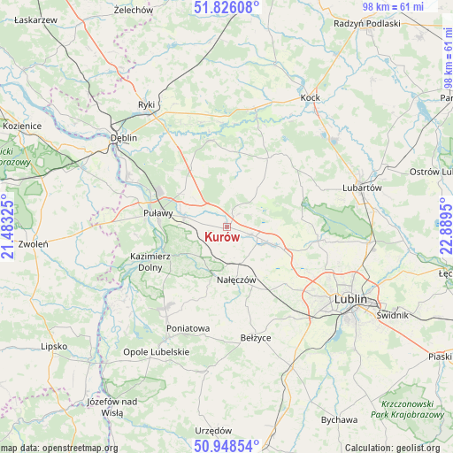
Kurów GPS coordinates[2]
51° 23' 21.876" North, 22° 11' 10.932" East
| Map corner | latitude | longitude |
|---|---|---|
| Upper-left | 51.82608°, | 21.48325° |
| Center: | 51.38941°, | 22.18637° |
| Lower-right: | 50.94854°, | 22.8895° |
| Map W x H: | 97.6×97.6 km | = 60.6×60.6mi |
| max Lat: | 54.83135° ⇑45.3% North |
| Kurów: | 51.38941° |
| min Lat: | ⇓54.7% South 49.21328° |
| min Long | Kurów | max Long |
| 14.20249° | 22.18637° | 24.03723° |
| W 87.2%⇐ | ⇒12.8% E |
Elevation
Elevation of Kurów is 159 m = 522 ft, and this is 32.4 m = 106 ft below average elevation for this country.
| Max E: |
974 m = 3196 ft | 54.9% |
| Avg. | 191.4 m = 628 ft | |
| Kurów | 159 m = 522 ft | |
Min E: |
-3 m = -10 ft | 45.1% |
See also: Poland elevation on elevation.city.
Geographical zone
Kurów is located in North temperate zone (between Tropic of Cancer and the Arctic Circle). Distance of this North polar circle is 1687.2 km =1048.4 mi to North.| Distance of | km | miles | from Kurów |
|---|---|---|---|
| North Pole | 4293.1 | 2667.6 | to North |
| Arctic Circle | 1687.2 | 1048.4 | to North |
| Tropic Cancer | 3108 | 1931.2 | to South |
| Equator | 5714 | 3550.5 | to South |


Nearby cities:
15 places around Kurów: (largest is in red/bold)
• Abramów
11.6 km =7.2 mi,  50°
50°
• Bałtów
15.9 km =9.9 mi,  314°
314°
• Brzozowa Gać
1 km =0.6 mi,  332°
332°
• Garbów
10.6 km =6.6 mi,  110°
110°
• Kazimierz Dolny
17.9 km =11.1 mi,  244°
244°
• Końskowola
9.6 km =6 mi,  283°
283°
• Markuszów
5.2 km =3.2 mi, 108°
• Michów
17.6 km =10.9 mi,  30°
30°
• Nałęczów
11.7 km =7.3 mi,  170°
170°
• Ożarów
13.2 km =8.2 mi,  143°
143°
• Przybysławice
6.9 km =4.3 mi, 108°
• Puławy
15.4 km =9.6 mi, 281°
• Wojciechów
17.6 km =10.9 mi, 166°
• Wąwolnica
10.9 km =6.8 mi,  194°
194°
• Żyrzyn
13.9 km =8.6 mi, 331°
Sources, notices
• [Note1] Compared only with cities in Poland existing in our database
• [Src1] Map data: © OpenStreetMap contributors (CC-BY-SA)
• [Src2] Other city data from geonames.org with taken over terms of usage.
• [Src3] Geographical zone / Annual Mean Temperature by Robert A. Rohde @ Wikipedia
