Żyrzyn geodata
Żyrzyn (Lublin) is a seat of a third-order administrative division; located in Poland in Europe/Warsaw (GMT+2) time zone. With population of 1,400 people, there are 1959 cities with bigger population in this country. Compared to other cities in Poland, 56.2% of cities are located further ↓South; 85.9% of cities are located further ←West and 57.1% of cities have higher elevation than Żyrzyn. Note1


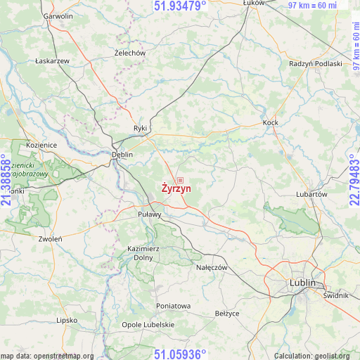
Żyrzyn GPS coordinates[2]
51° 29' 57.048" North, 22° 5' 30.12" East
| Map corner | latitude | longitude |
|---|---|---|
| Upper-left | 51.93479°, | 21.38858° |
| Center: | 51.49918°, | 22.0917° |
| Lower-right: | 51.05936°, | 22.79483° |
| Map W x H: | 97.3×97.3 km | = 60.5×60.5mi |
| max Lat: | 54.83135° ⇑43.8% North |
| Żyrzyn: | 51.49918° |
| min Lat: | ⇓56.2% South 49.21328° |
| min Long | Żyrzyn | max Long |
| 14.20249° | 22.0917° | 24.03723° |
| W 85.9%⇐ | ⇒14.1% E |
Elevation
Elevation of Żyrzyn is 153 m = 502 ft, and this is 38.4 m = 126 ft below average elevation for this country.
| Max E: |
974 m = 3196 ft | 57.1% |
| Avg. | 191.4 m = 628 ft | |
| Żyrzyn | 153 m = 502 ft | |
Min E: |
-3 m = -10 ft | 42.9% |
See also: Poland elevation on elevation.city.
Geographical zone
Żyrzyn is located in North temperate zone (between Tropic of Cancer and the Arctic Circle). Distance of this North polar circle is 1675 km =1040.8 mi to North.| Distance of | km | miles | from Żyrzyn |
|---|---|---|---|
| North Pole | 4280.9 | 2660 | to North |
| Arctic Circle | 1675 | 1040.8 | to North |
| Tropic Cancer | 3120.3 | 1938.9 | to South |
| Equator | 5726.2 | 3558.1 | to South |


Nearby cities:
15 places around Żyrzyn: (largest is in red/bold)
• Abramów
16.2 km =10.1 mi,  107°
107°
• Baranów
7.2 km =4.5 mi,  25°
25°
• Bałtów
4.8 km =3 mi,  257°
257°
• Bobrowniki
12.3 km =7.6 mi,  296°
296°
• Brzozowa Gać
12.8 km =8 mi,  151°
151°
• Jeziorzany
17.2 km =10.7 mi,  48°
48°
• Końskowola
10.4 km =6.5 mi,  195°
195°
• Kurów
13.9 km =8.6 mi, 151°
• Markuszów
18 km =11.2 mi,  140°
140°
• Michów
15.7 km =9.8 mi,  79°
79°
• Moszczanka
14.2 km =8.8 mi,  322°
322°
• Nowodwór
15.6 km =9.7 mi,  2°
2°
• Puławy
12.5 km =7.8 mi,  222°
222°
• Ryki
17.9 km =11.1 mi, 322°
• Ułęż
10.4 km =6.5 mi,  6°
6°
Sources, notices
• [Note1] Compared only with cities in Poland existing in our database
• [Src1] Map data: © OpenStreetMap contributors (CC-BY-SA)
• [Src2] Other city data from geonames.org with taken over terms of usage.
• [Src3] Geographical zone / Annual Mean Temperature by Robert A. Rohde @ Wikipedia
